

Friday’s forecast:
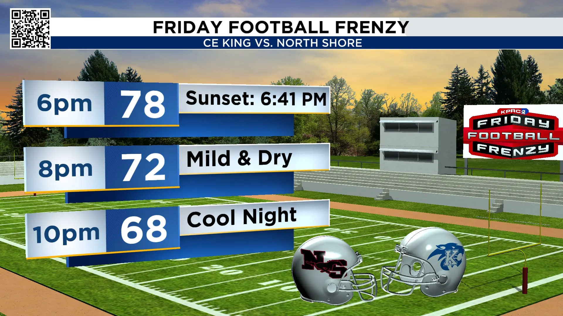
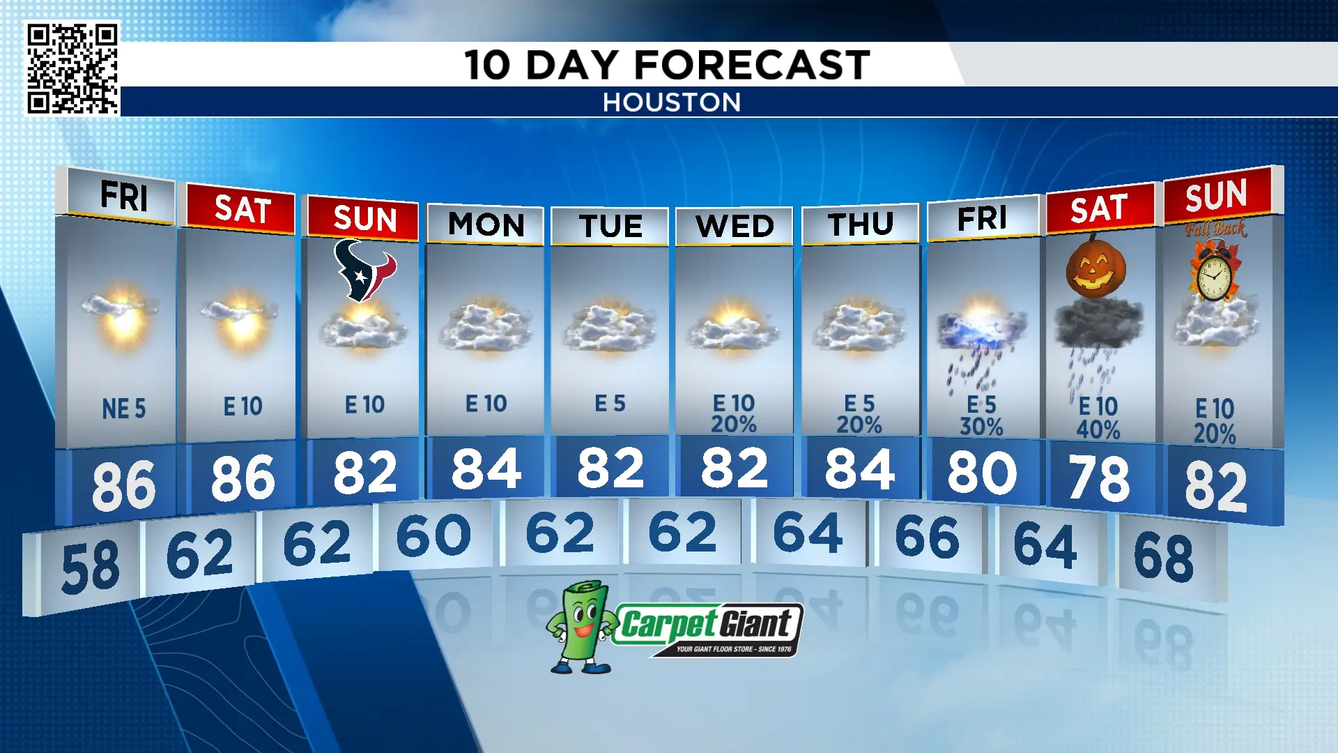
We end our work week with near-perfect weather. It’s a chilly start to the day with temperatures in the 50s, and we warm up to the mid-80s under sunny skies. It will be another day with a light northeasterly dry wind around 5 mph. Because of the calm winds, there may be some ozone pollution issues that develop late in the afternoon. Friday night will feel tremendous. For those of you going to Friday football games, temperatures start in the 70s and fall to the 60s late.
Saturday and Sunday’s forecast:
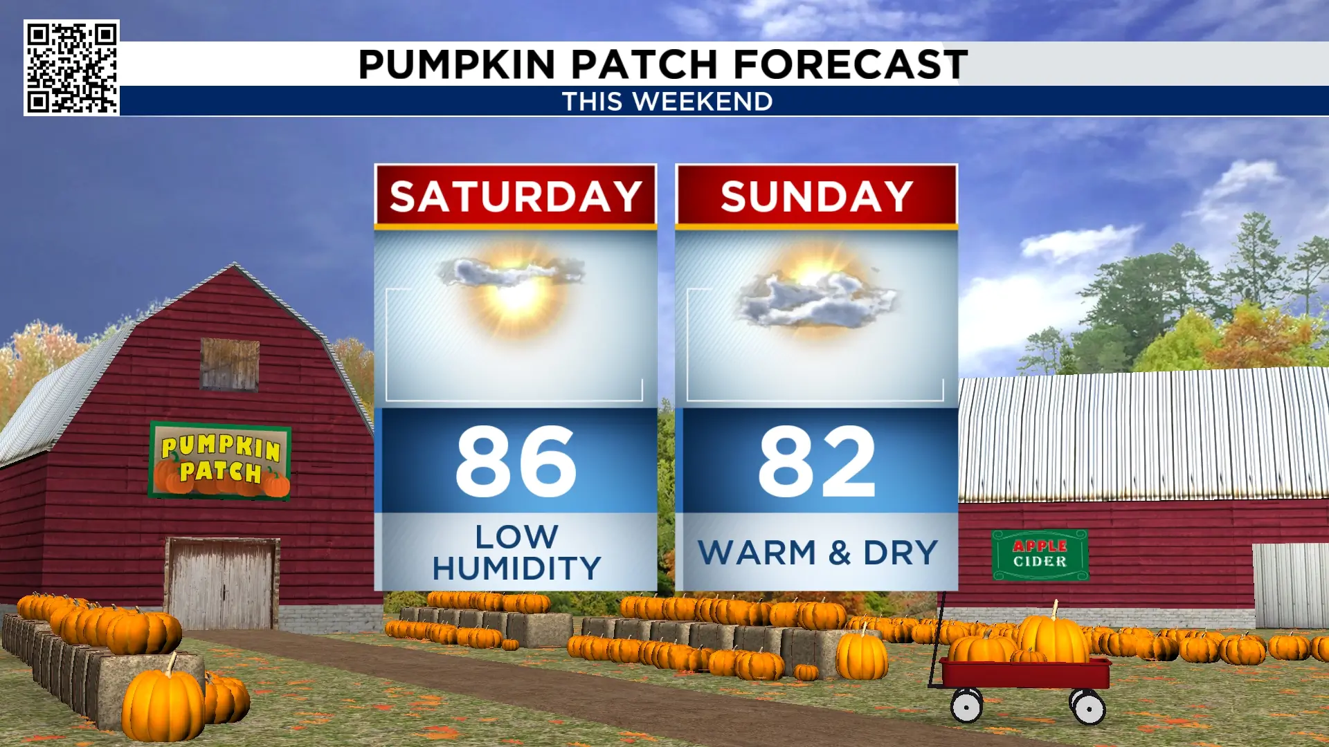
There aren’t any major changes this weekend, so I’m combining Saturday and Sunday. Humidity remains on the low side with mostly sunny skies both days. Mornings start in the lower 60s with highs in the lower and mid-80s. There will be a little more of a breeze Saturday with easterly winds of 10-15 mph. Make sure you are spending some time outside this weekend.
Weather pattern change next week:
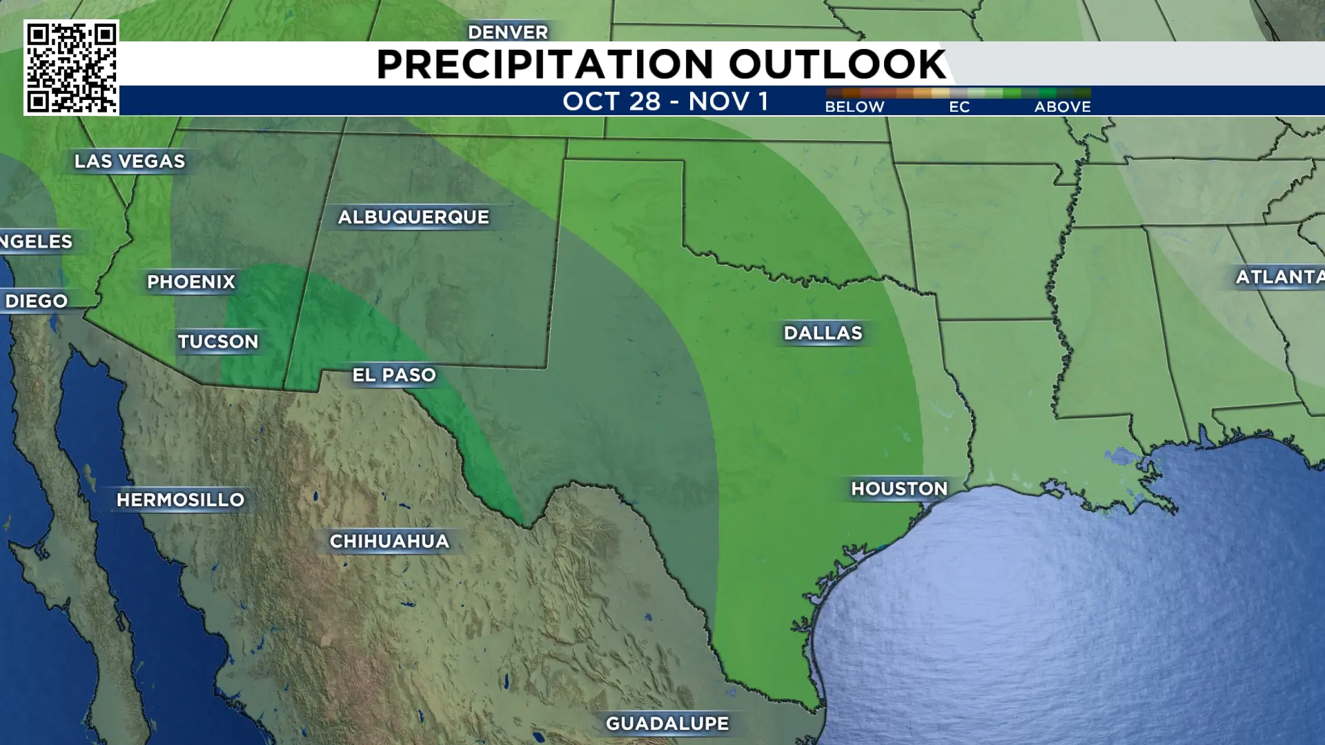
Mid-week, our weather pattern changes. Tropical moisture from Hurricane Vance moves into the state of Texas. This, coupled with an area of low pressure, will bring rain as early as Wednesday, with heaviest rain falling on Halloween. We don’t have a specific timing yet because we are more than a week away from next Saturday, but I wanted to give you an early heads up.
Daylight saving time comes to an end next weekend:
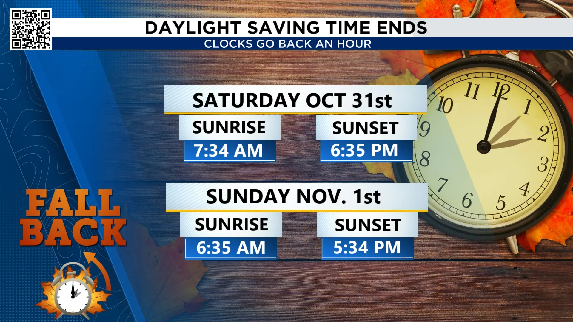
Early Sunday, November 1st, we turn our clocks back one hour. 2 am becomes 1 pm and we seemingly get an extra hour of sleep. Below is how this affects sunrise and sunset.
Tracking the tropics:
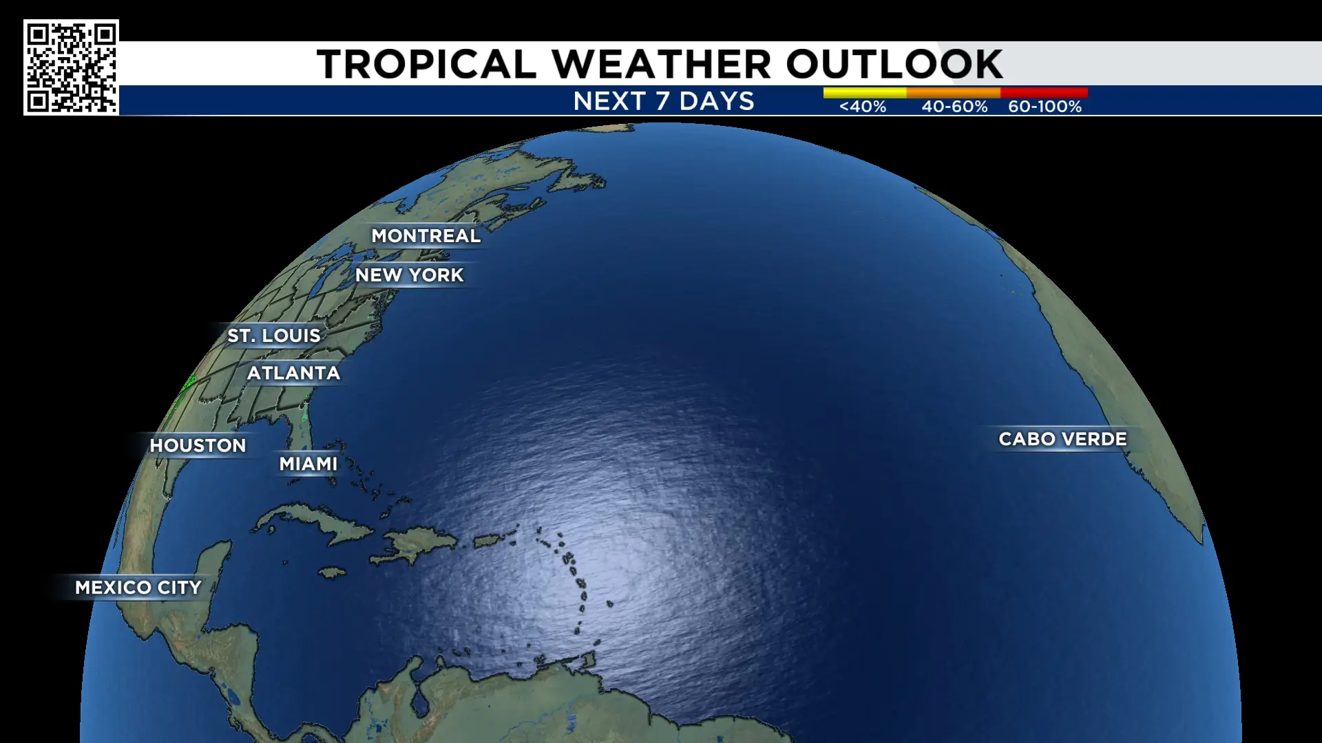
The Atlantic is now quiet, and no tropical development is expected in the next 7 days.
Extended forecast:
The gorgeous weather continues through early next week, with slight rain chances returning Wednesday. Rain on Halloween “may” impact your plans. It is still too early to be specific on timing, so don’t make any changes to your plans just yet.

More Stories Like This In Our Email Newsletter

