

Halloween Rain Timeline:
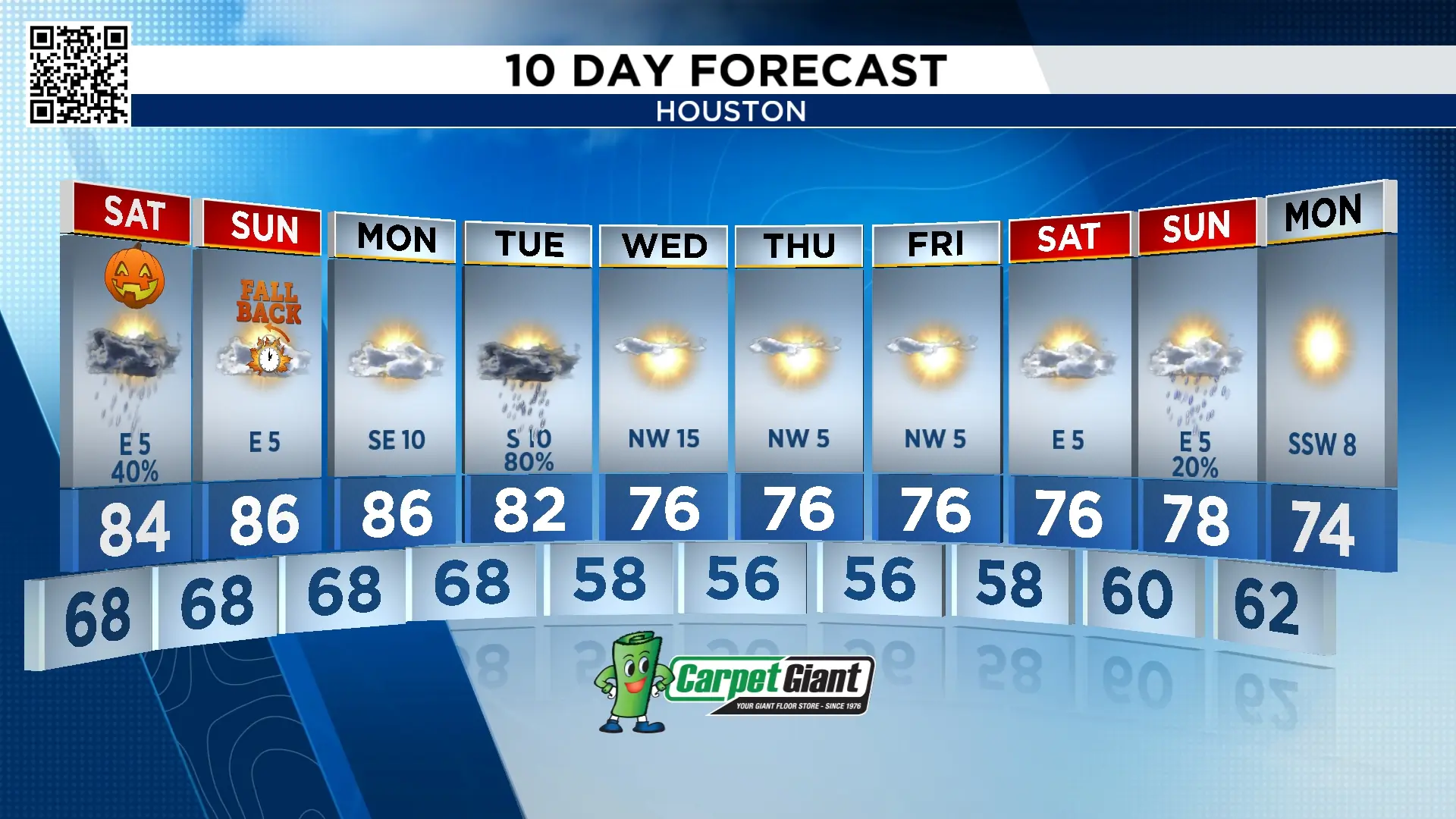
Keep the umbrellas near by as another round of spotty to scattered showers and storms return Saturday. The first half the day is dry with partly to mostly cloudy skies.
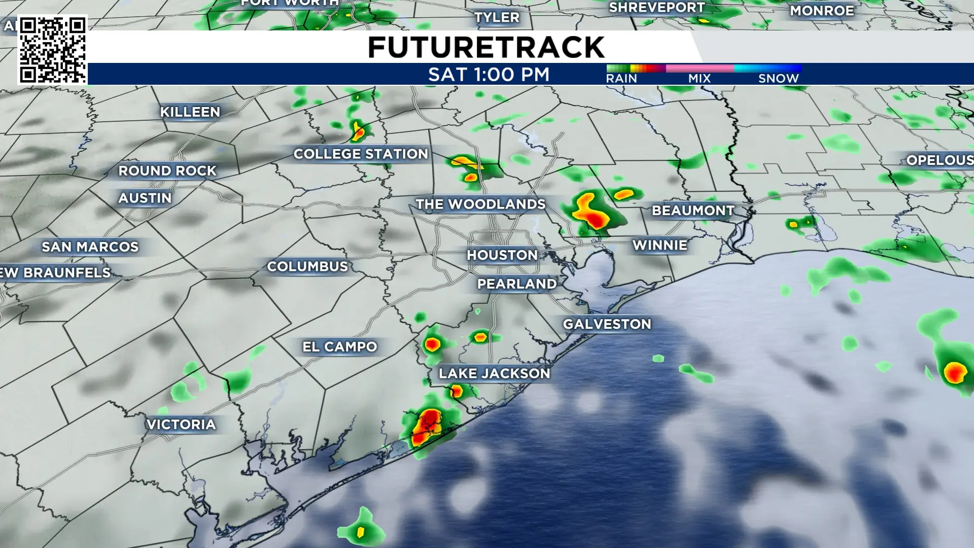
Rain begins to turn scattered Saturday evening so from 5 pm to 7 pm is when you need the rain gear. Most areas begin to dry out starting at 8 pm.
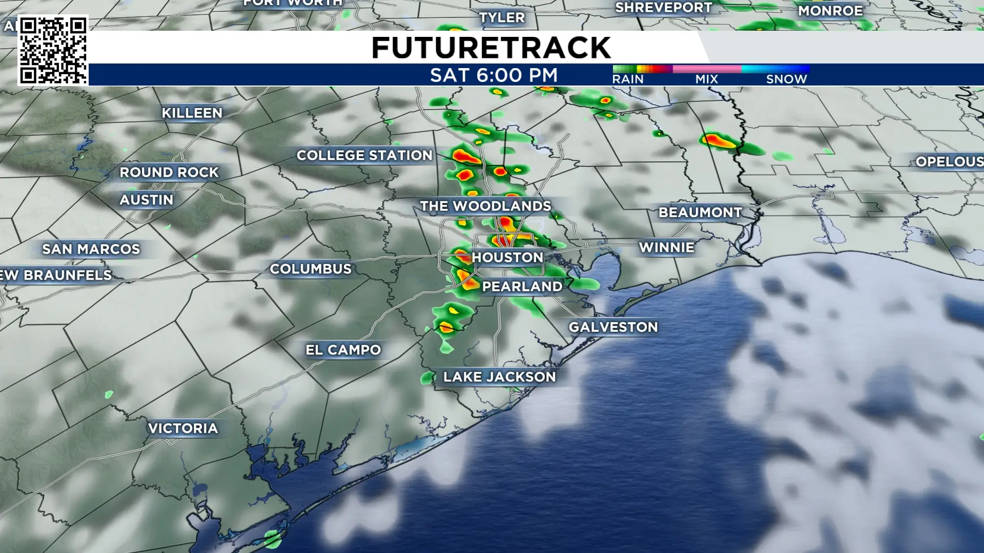
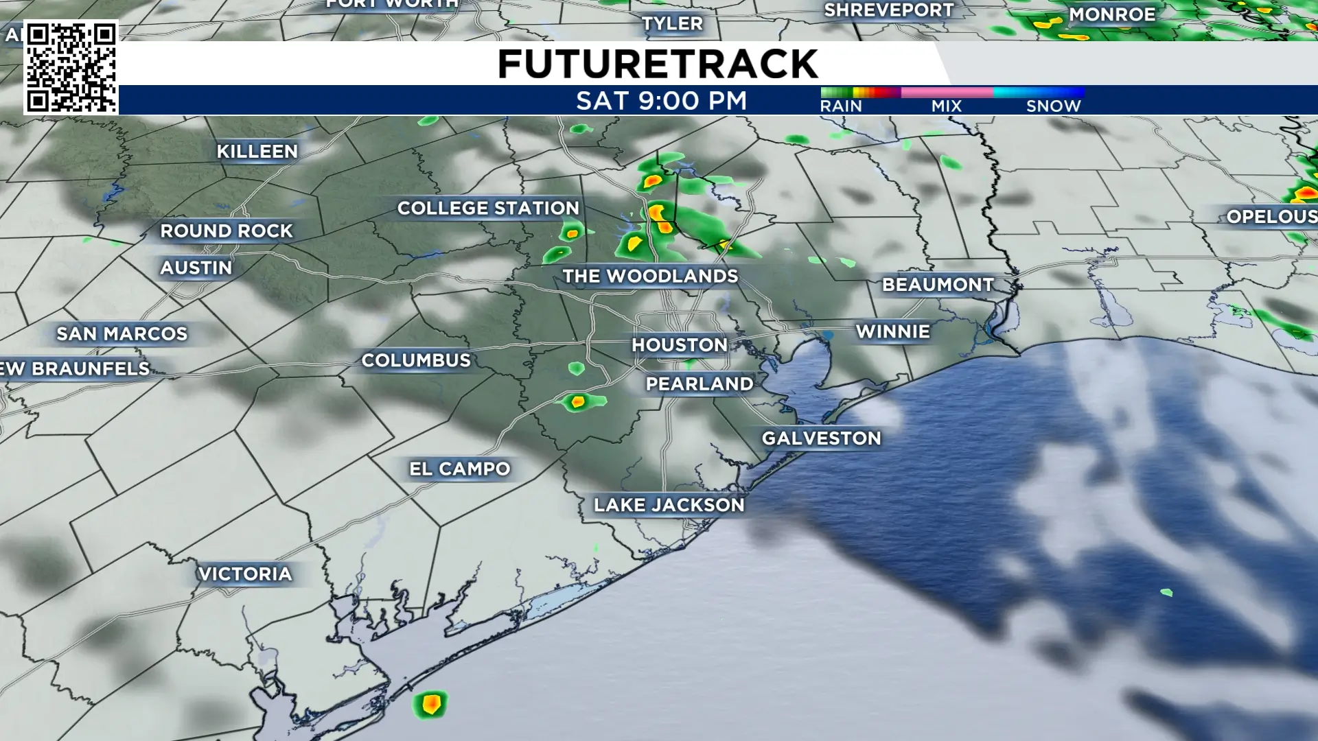
Temperatures remain mild through sunset.
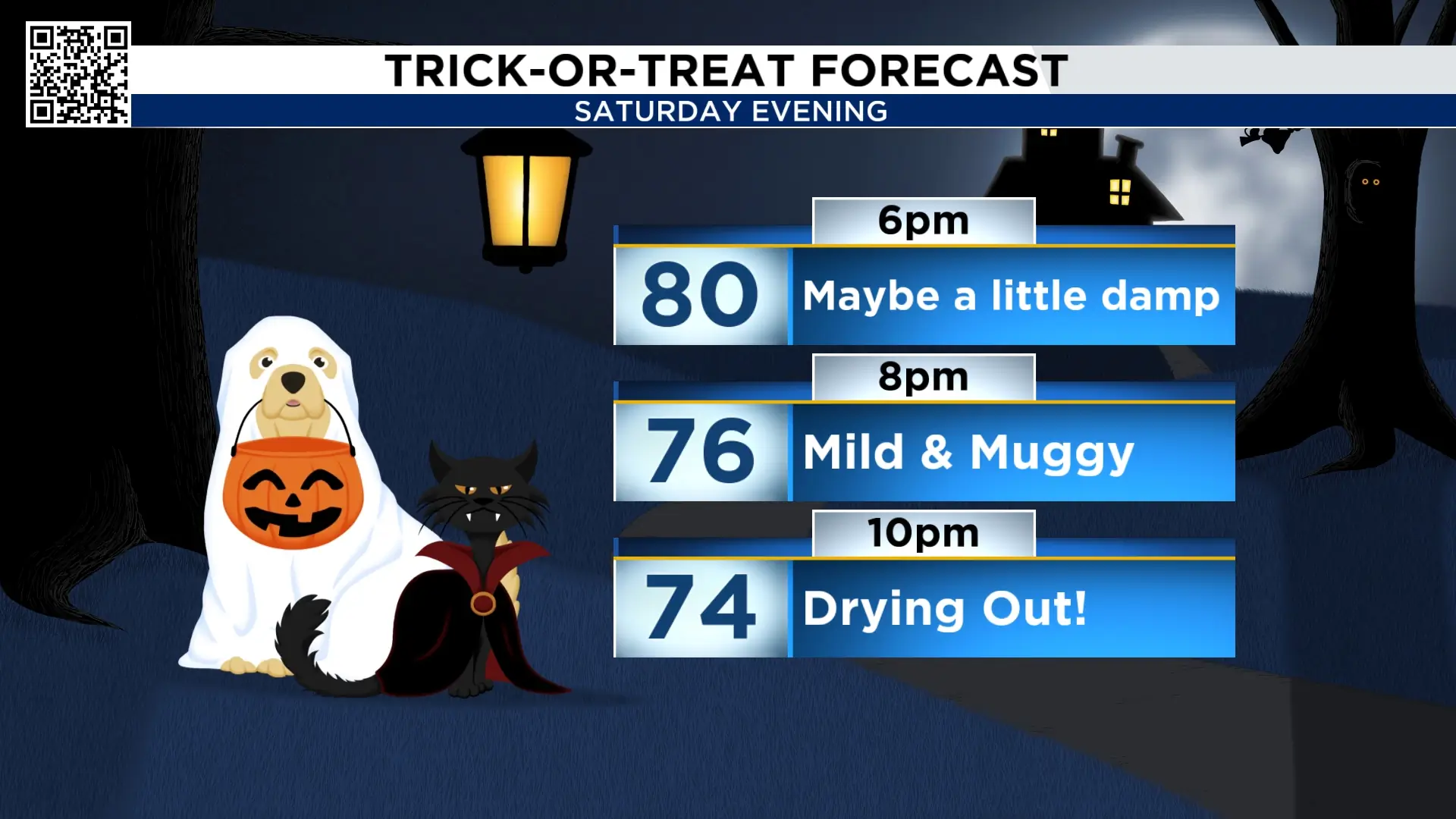
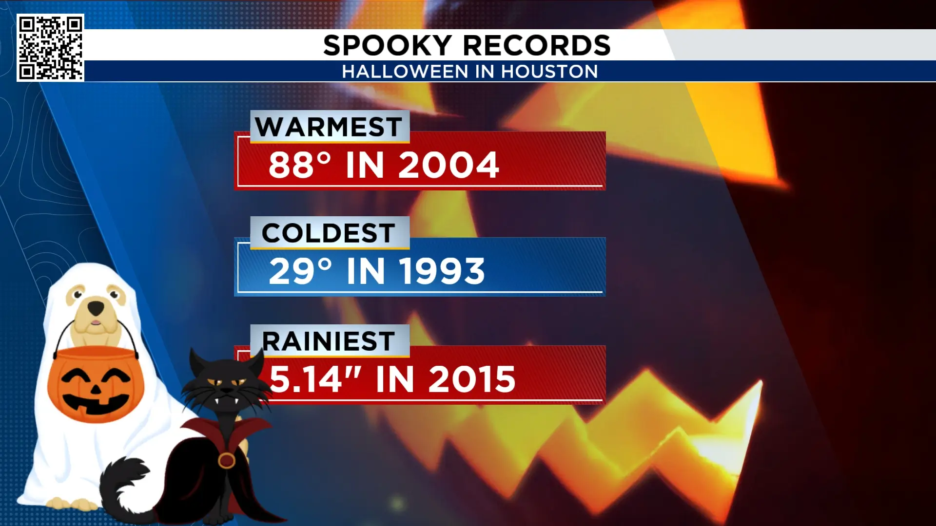
By the way, the high of 84° on Halloween is putting us near one of the warmest Halloweens ever recorded. In 2004 we climbed to 88°. This year’s high reaches the mid-80s.
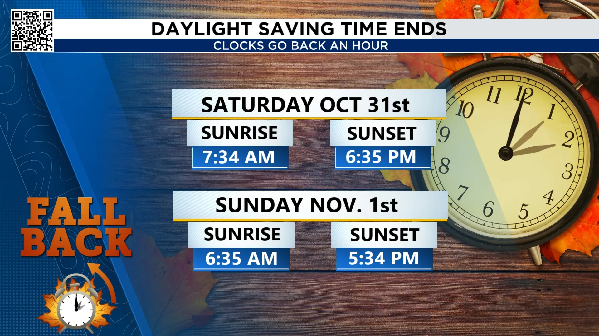
Daylight saving time comes to an end early Sunday morning:
Early Sunday, November 1st, we turn our clocks back one hour. Don’t forget this! 2 am becomes 1 a.m., and we seemingly get an extra hour of sleep. Below is how this affects sunrise and sunset.
Election Day cold front:
After Halloween, we’re watching for some stormy weather on Election Day. Tuesday, a cold front will bring a threat of showers and some strong thunderstorms through the afternoon and early evening hours.
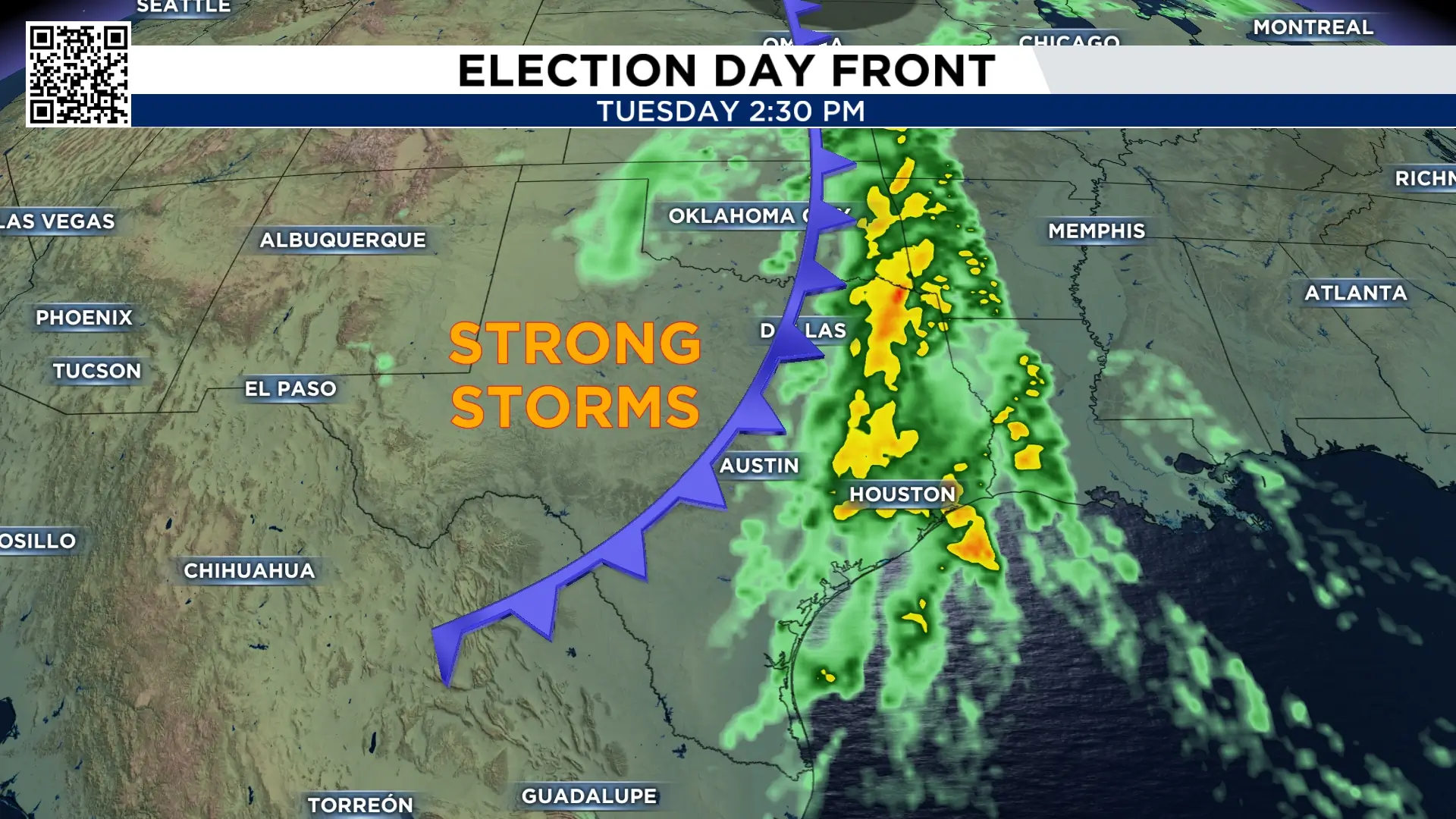
The timing will adjust, but for now it looks like it moves through Tuesday afternoon. This will move temperatures back to the 50s and 70s and drop the humidity again. More details to come on this.
Extended forecast:
The humidity is back in full force Friday and will remain high through Monday. Election Day Tuesday’s front lowers morning temperatures back to the 50s, with afternoons in the 70s. A northwesterly wind will dry out the air, bringing a fantastic fall feel.

More Stories Like This In Our Email Newsletter
