

Recommended Videos
Early Week Forecast:
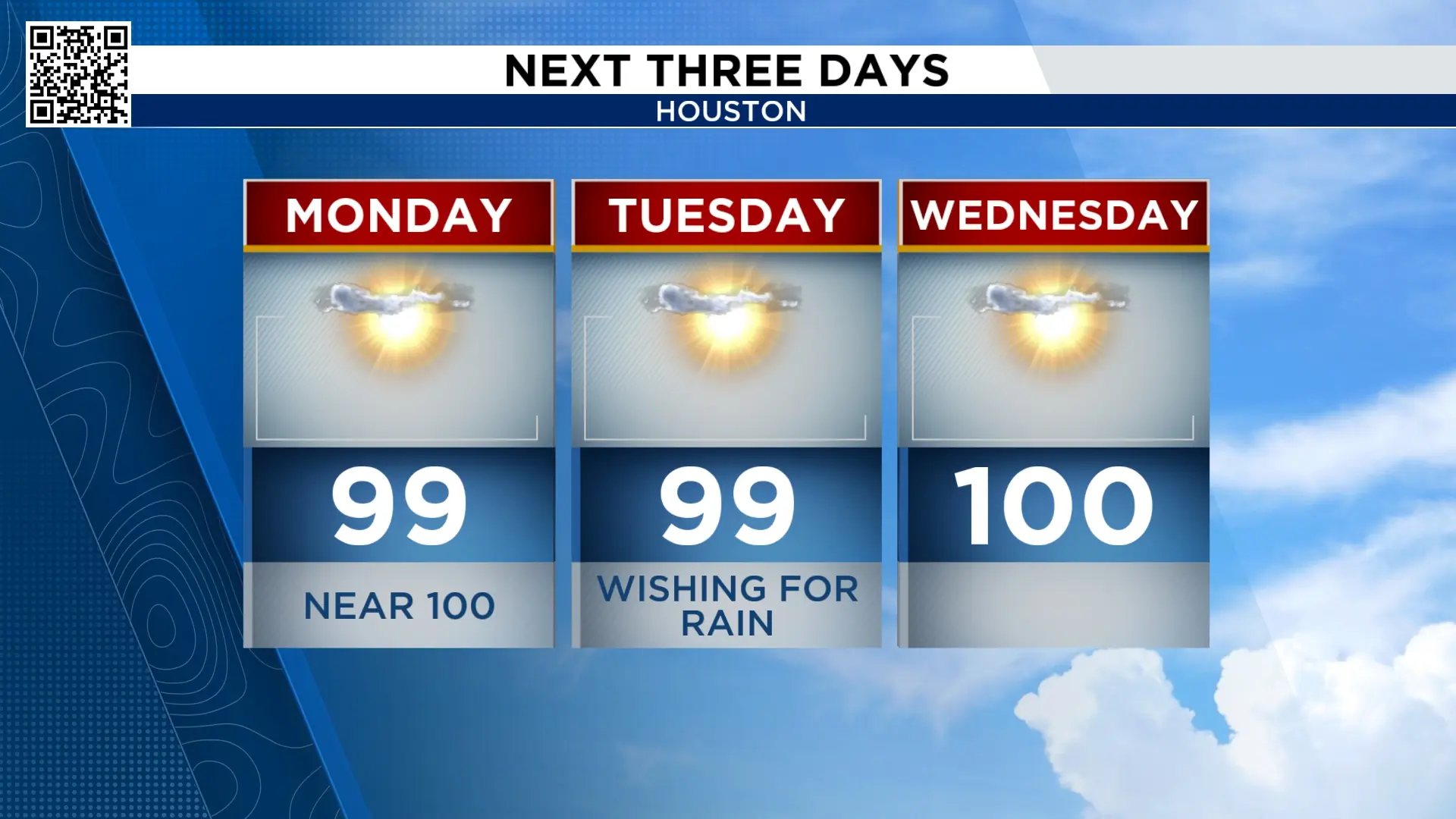
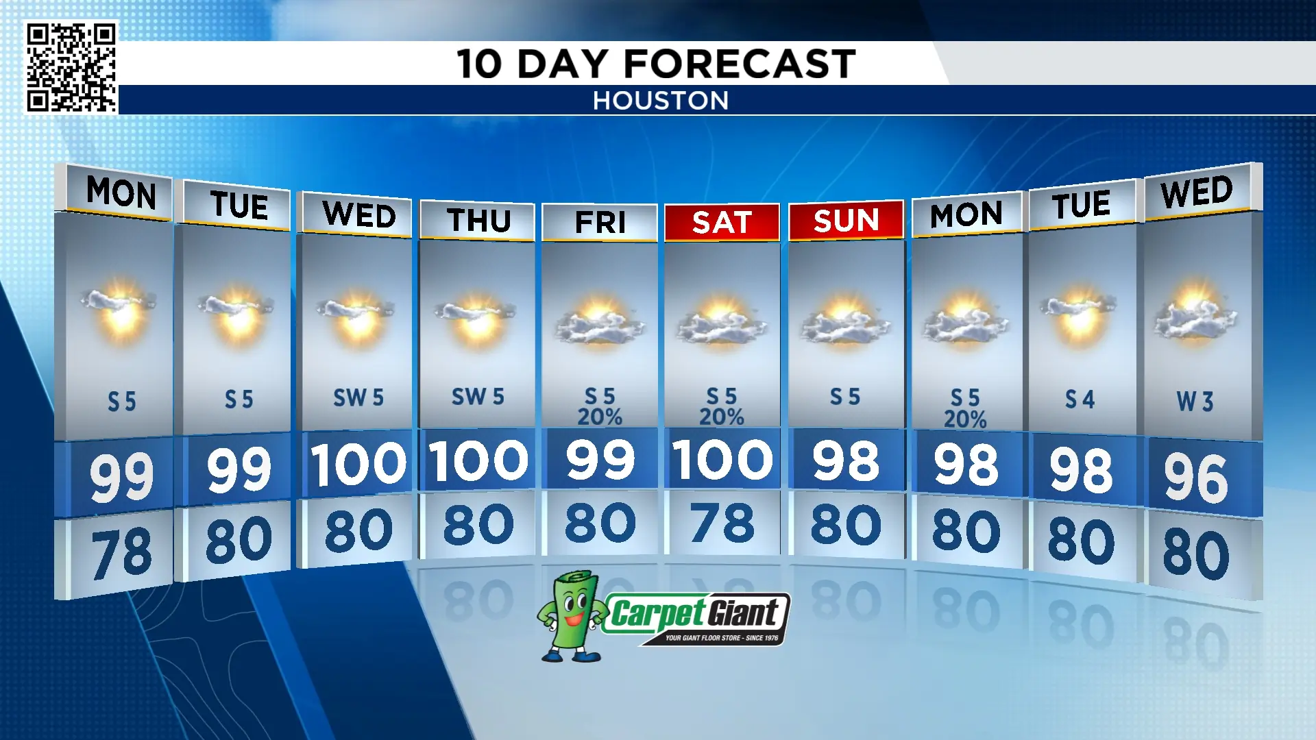
High pressure continues to bringing a hot, humid and dry weather pattern that looks to stick around beyond Monday.
Houston won’t get an opportunity at rain until late week, and the chance is only around 20%.
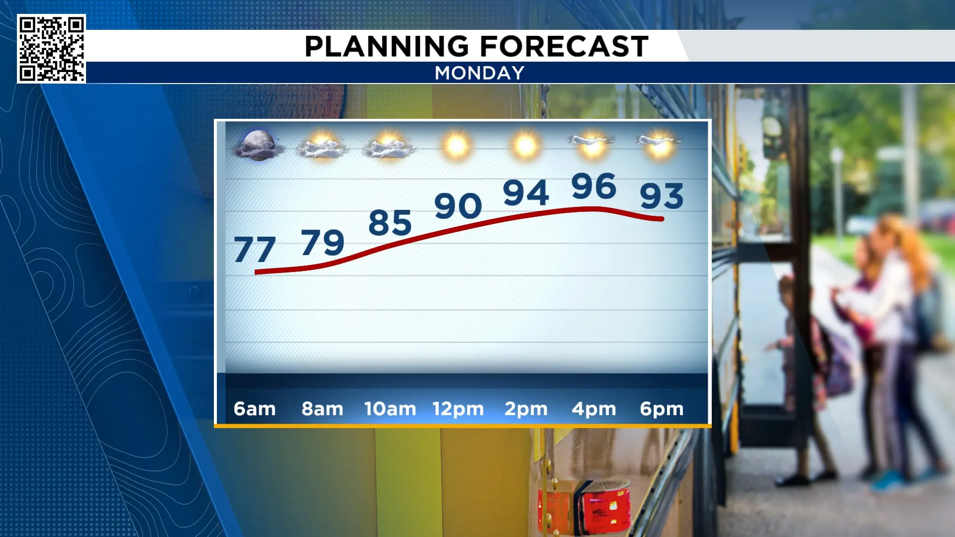
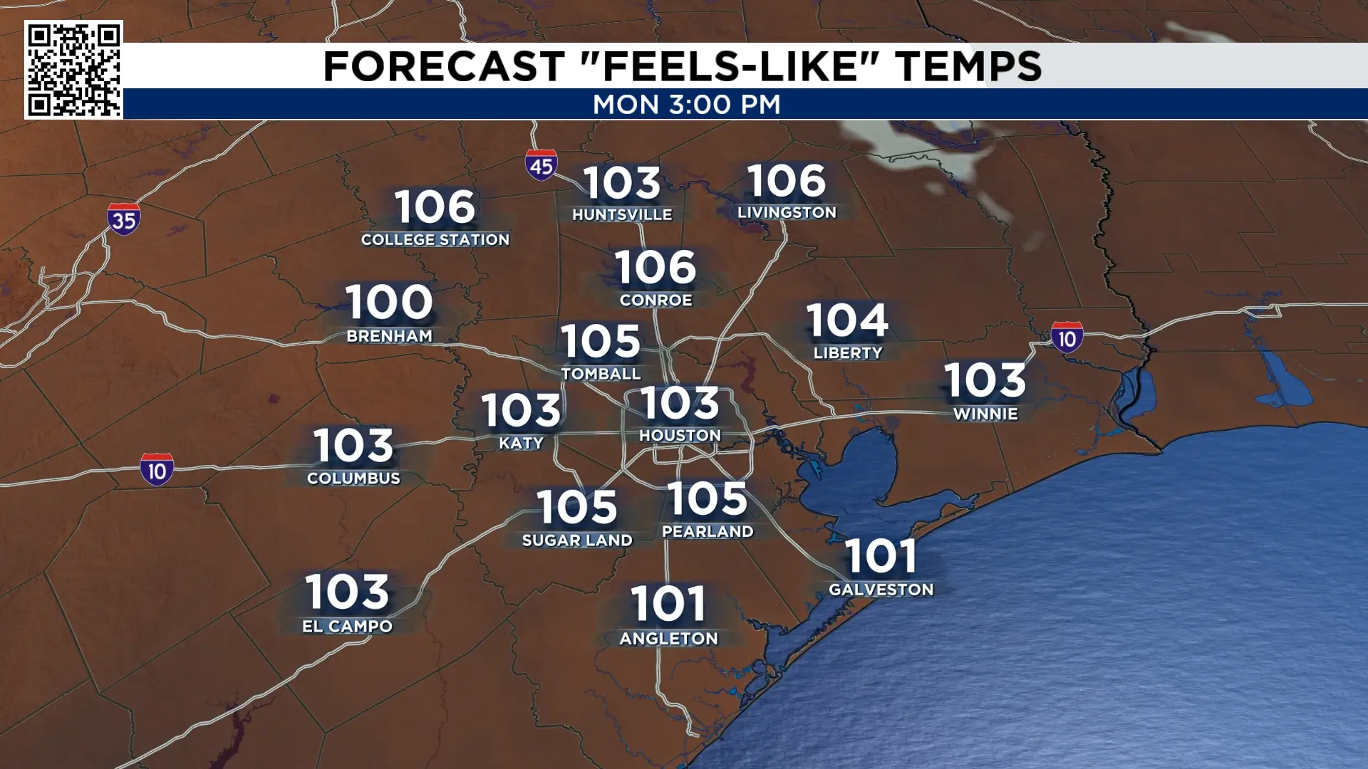
Temperatures will climb into the upper 90s, with the potential to hit 100° on a few days this week. With the humidity, it will feel even hotter.
Lala and Hawaii:
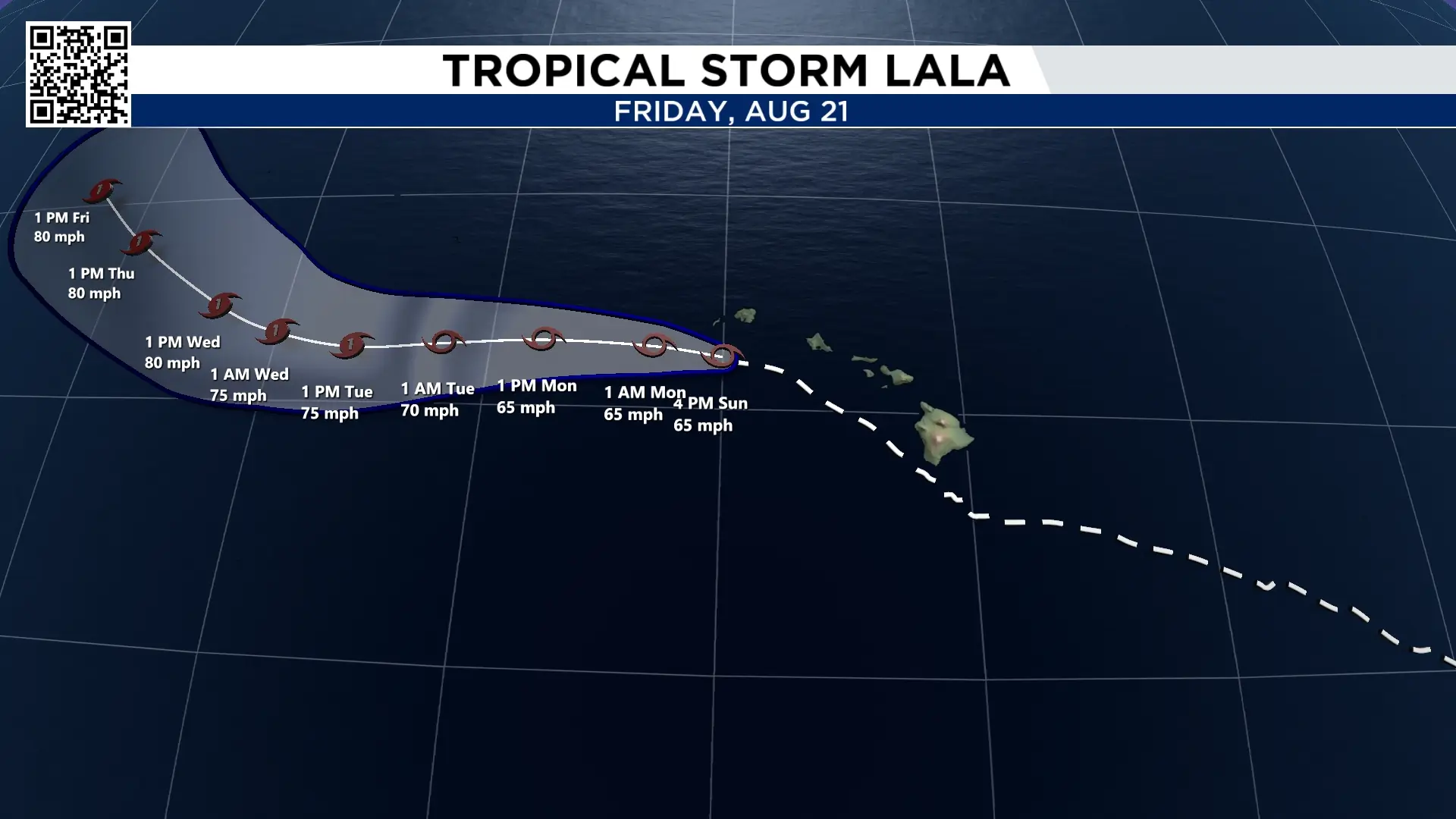
Lala did not make landfall, but it did bring a foot of rain across parts of the Big Island, as it passed just to the south of the Island. The storm continues to move NW and its rainbands are now impacting Maui and Honolulu. Still watching for the potential for mudslides as the torrential rainfall continues.
Hurricane force winds hit parts of the big island lashing trees and knocking out power.
Waves as high as twenty feet will lash the southern parts of Hawaii.
The storm continues to pull away from Hawaii Sunday night and by Monday morning looking at improvements.
Atlantic Ocean:
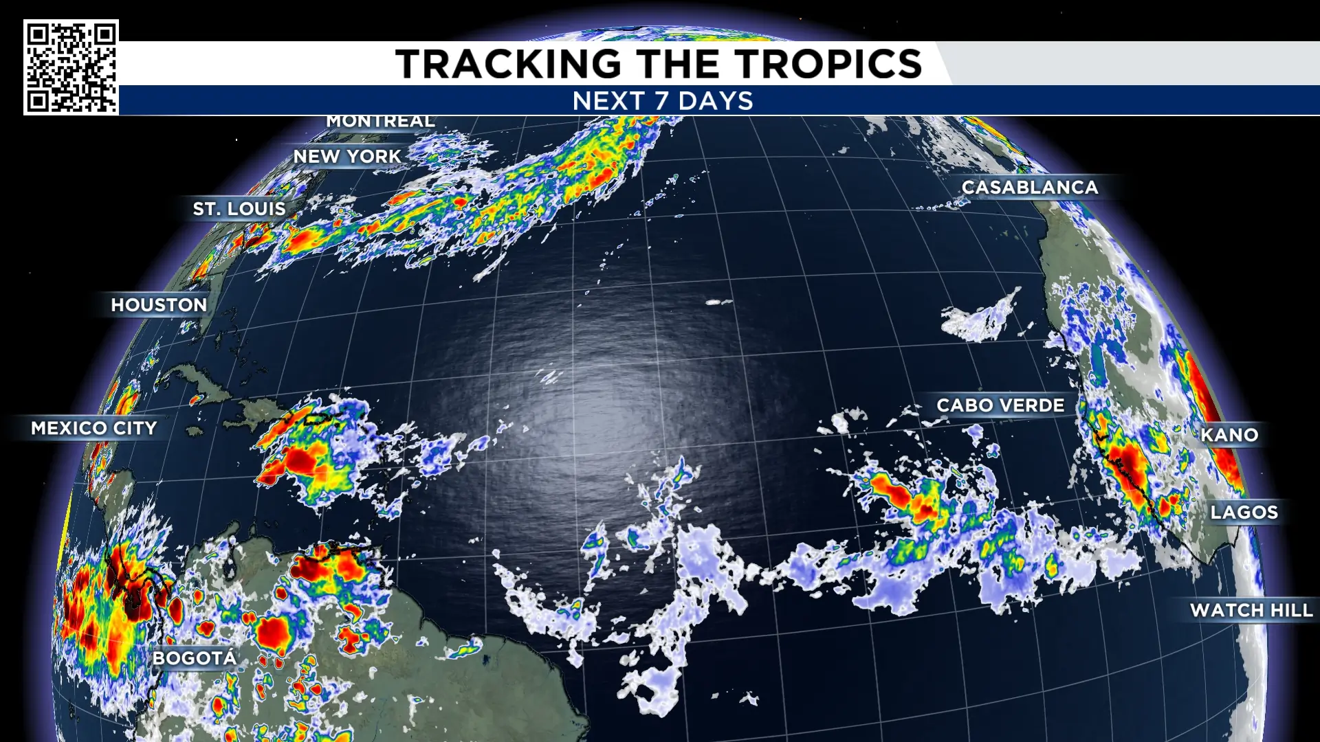
While the Pacific Ocean has Lala, the Atlantic basin has dry air and strong wind shear. This is preventing the disturbances from strengthening. No activity is expected over the next 7 days.
10 Day Forecast:
I don’t have a chance of rain in the forecast until Friday and it is far from a wash out.

More Stories Like This In Our Email Newsletter
