

Recommended Videos
Thursday’s Forecast:
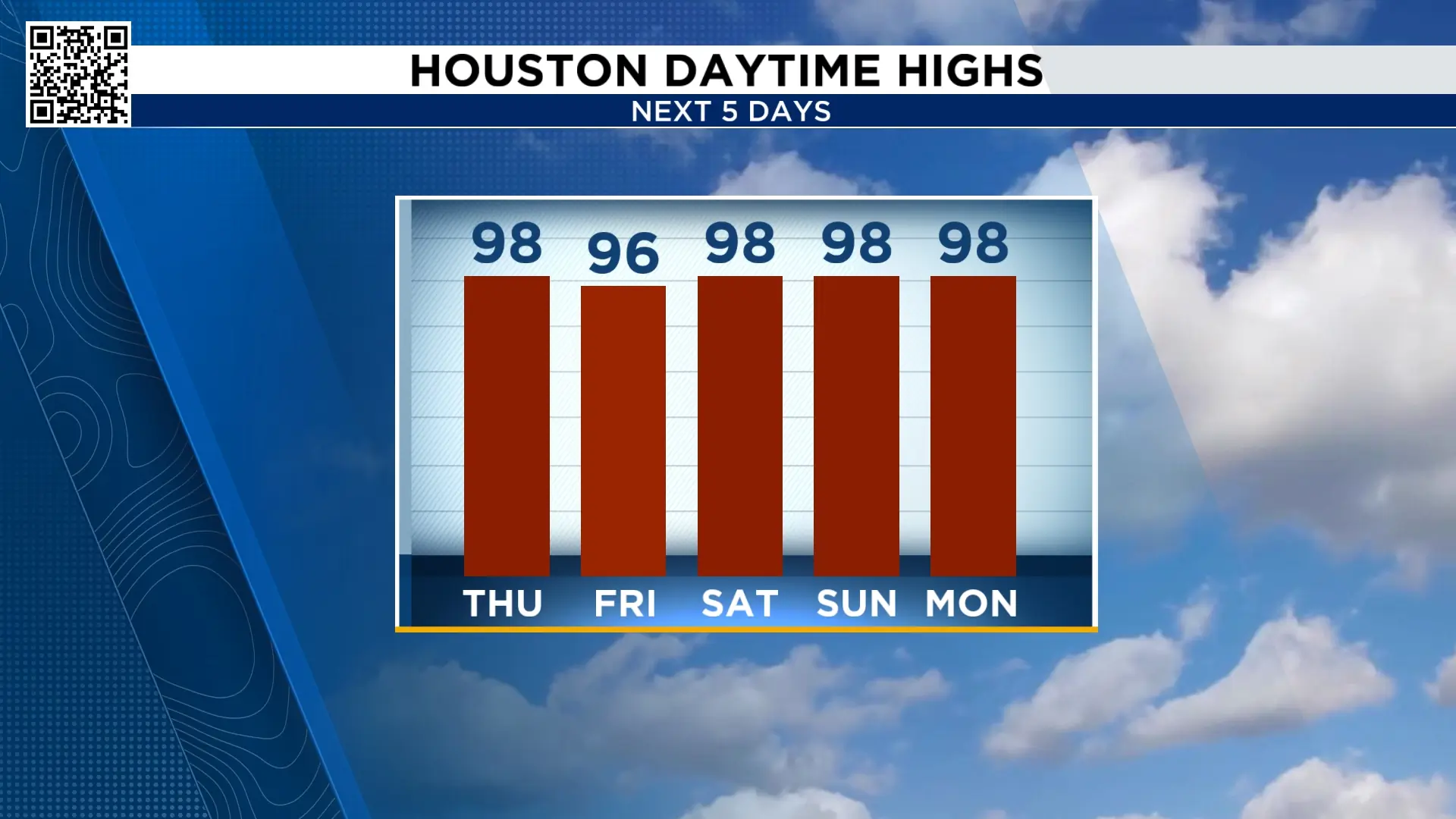
Did you know today marks a unique point in Houston’s climate calendar? On August 13, the average high drops from 96° to 95°. From a climatological standpoint, that means we’re now on the downhill side of summer, with average temperatures gradually cooling for the rest of the year.
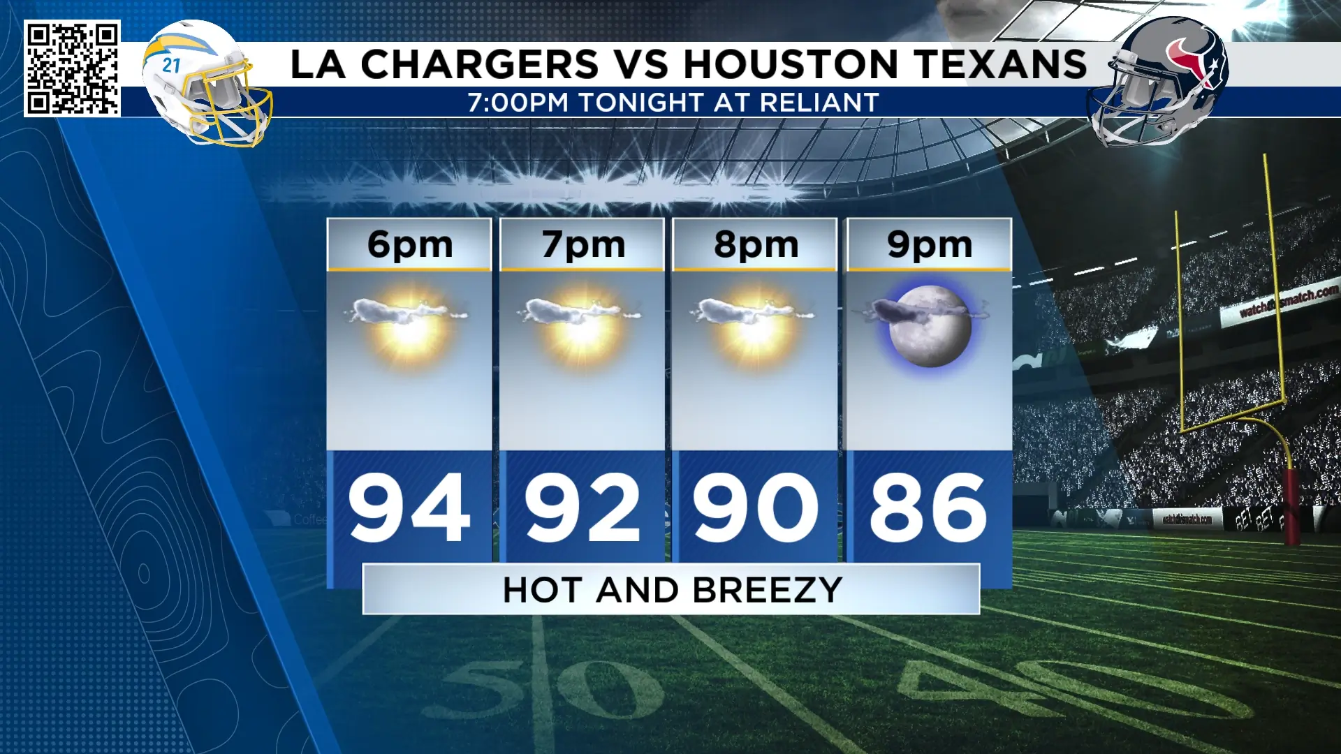
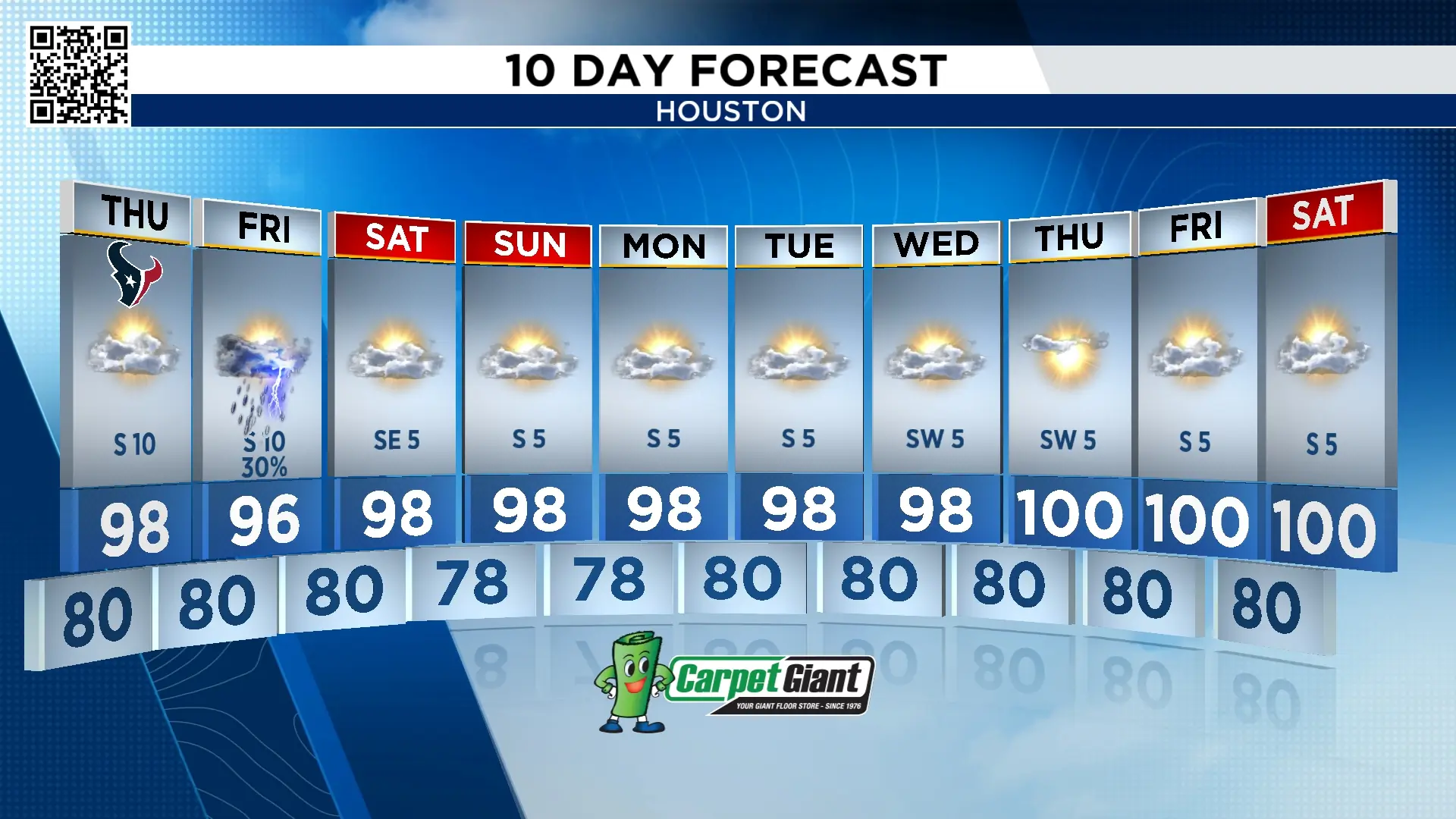
Now don’t get too excited. Houston won’t feel cooler anytime soon. We’re heading into a stretch of hot, humid weather, with Thursday’s high expected to reach 98°. Add the humidity, and it will feel like 108°. If you’re planning on tailgating before the Texans game tonight, make sure you wear sunscreen and drink plenty of water.
Chance of rain Friday:
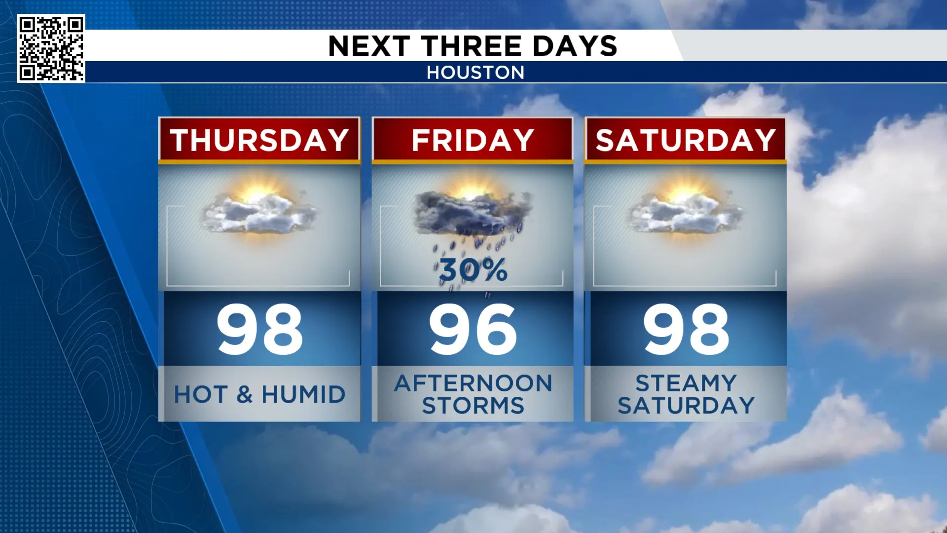
Our next slug of tropical moisture arrives Friday, bringing more clouds, higher humidity and a slight drop in temperatures.
We could start the day with coastal showers and thunderstorms before storms gradually move north during the afternoon. However, the area of high pressure steering this moisture into Southeast Texas will also limit widespread rainfall. Sinking air associated with the high will work against more organized shower and thunderstorm development.
Overall, we’re looking at a 30% chance of storms.
Tracking the tropics:
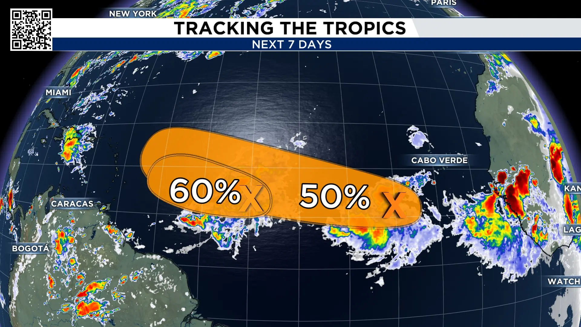
There are two disturbances we’re watching in the Atlantic. The more westward disturbance’s formation odds have been brought down to medium by the National Hurricane Center. With the high amount of shear and dry air ahead of it, we would expect it to weaken quickly even if it makes its way to tropical depression or storm status.
The second disturbance only has a 50% chance of development.
Watching Hawaii for tropical impact:
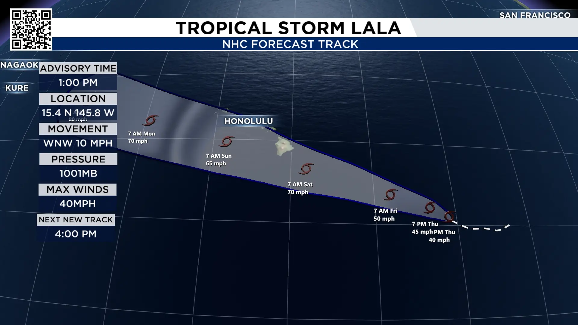
Hawaii is in the projected path of Tropical Storm Lala in the Central Pacific. While the official forecast from the Hurricane Center currently brings Lala over the islands as a tropical storm, some computer models show a stronger system, with the potential to reach Category 1 hurricane strength.
Regardless of the storm’s eventual strength, the biggest concerns for the islands will be strong winds, heavy rainfall and large, dangerous ocean currents.
10 Day Forecast:
After Friday, our rain chances drop to essentially zero. Temperatures will climb back into the upper 90s, and we’ll likely see several days where the heat index climbs high enough for a Heat Advisory to be issued.
In other words, enjoy Friday’s slightly cooler, wetter weather because the heat comes roaring back this weekend.

More Stories Like This In Our Email Newsletter

