
Live Radar:
Back to school forecast:
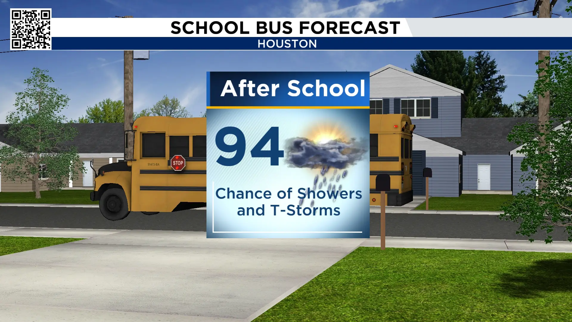
Lots of booms and downpours for Monday but Tuesday’s forecast should keep storm chances a little less intense and less widespread. However, there are still some areas that will see some quick heavy downpours anywhere from noon through 5pm which means school pickup could again be messy for a few. In addition to the rain, it will be hot with most areas seeing highs in the mid 90s.
Tracking the tropics:
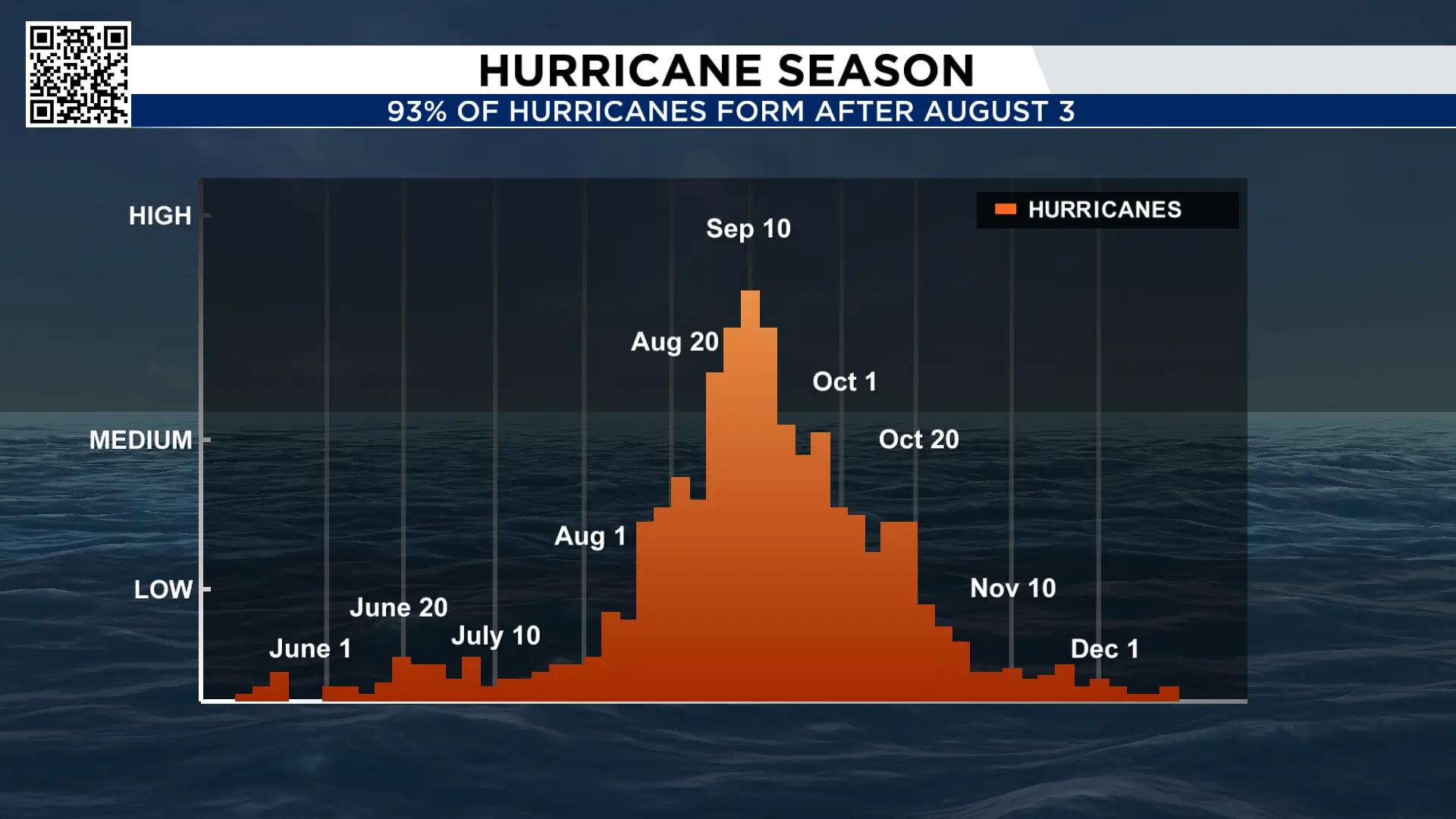
August is the “real” start of the hurricane season. 93% of hurricanes form after August 3rd. However, this is not your typical hurricane season. With an incredibly strong El Nino the numbers will be kept way down this season. Wind shear in the Caribbean is the strongest it’s been since 1979. Oh, and there is some thick Saharan dust over the Atlantic.
The National Hurricane Center has been tracking two tropical waves that could develop over the next 7 days. The conditions aren’t ideal but we may be seeing the second system holding together to become Cristobal, the next name on the list.
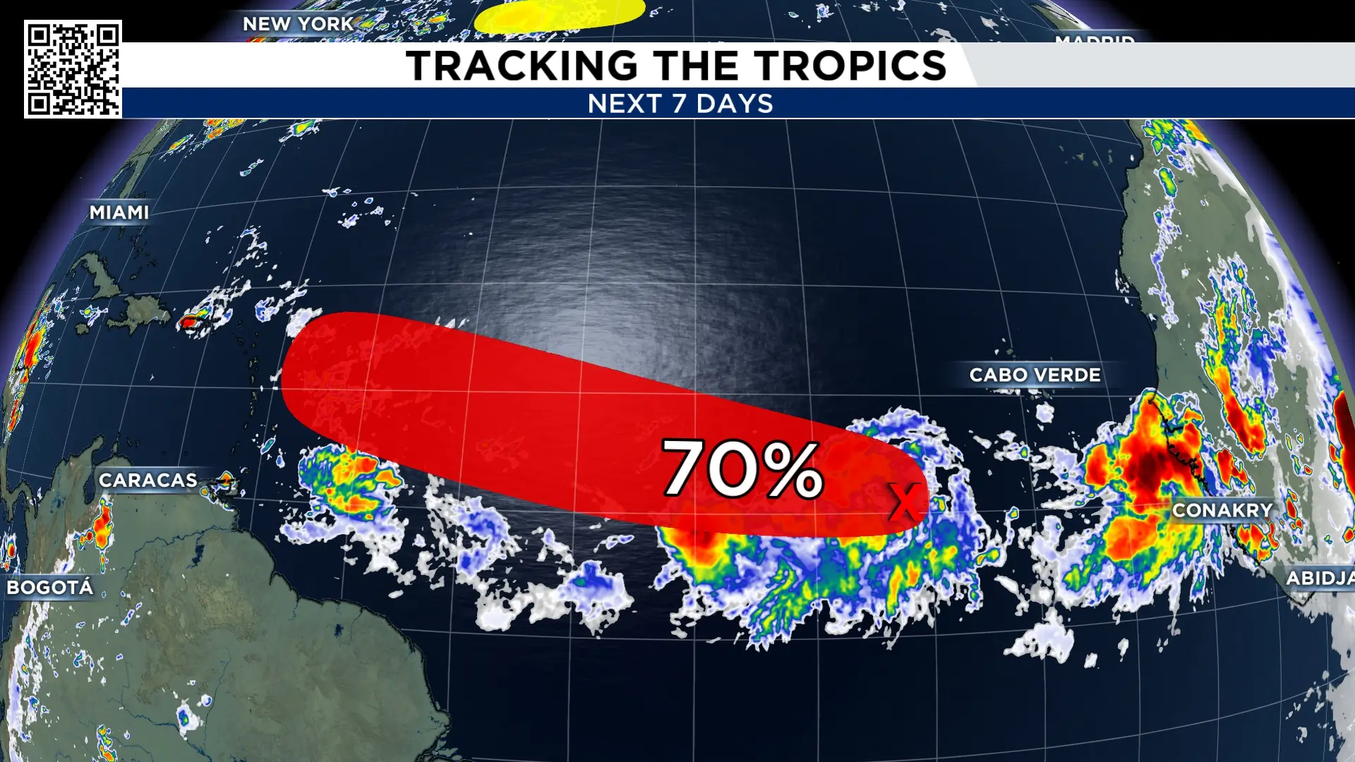
The more westerly disturbance now has a 0% chance of development and other has a 70% chance. The disturbances will have to overcome high levels of wind shear that is currently in the Atlantic.
There is also a disturbance moving away from the east coast which has a very low chance of development.
10 Day Forecast:
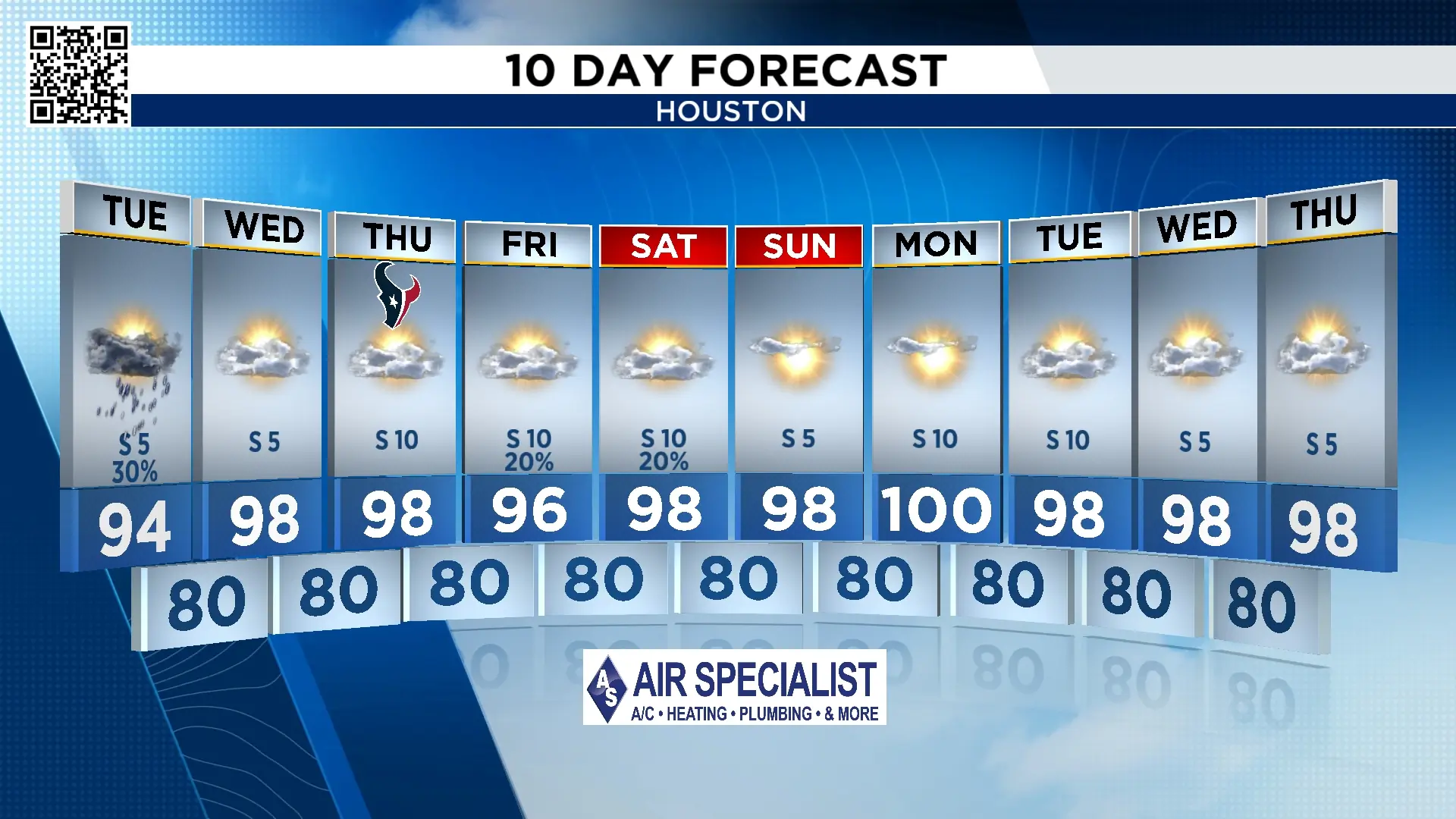
Rain chances stay slim through most of your work week as the heat cranks back up.

More Stories Like This In Our Email Newsletter

