
Recommended Videos
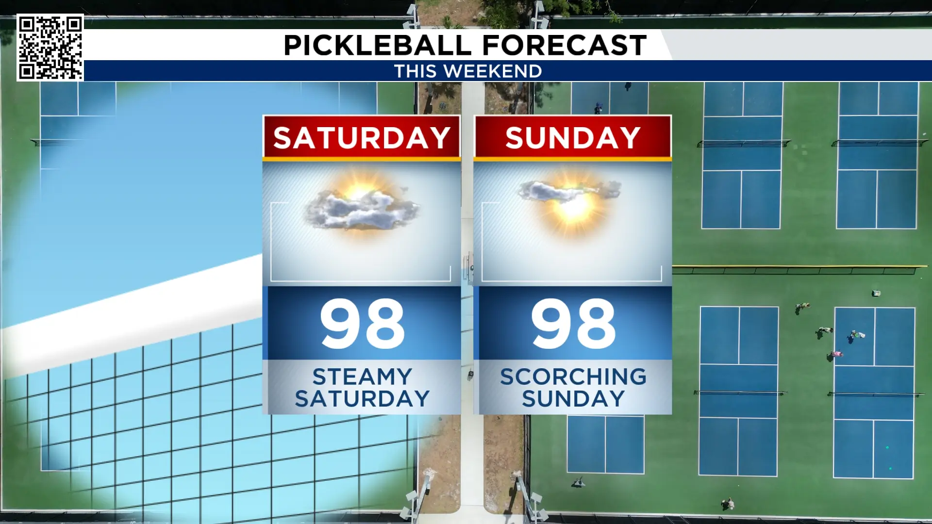
Our weekend’s forecast:
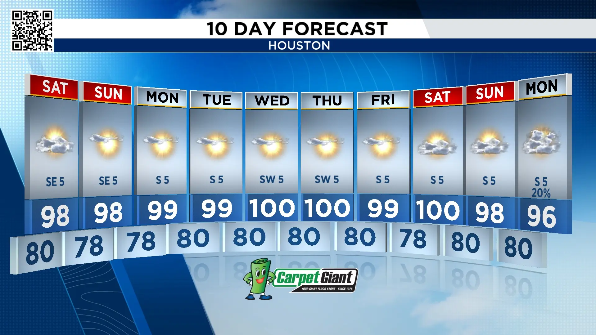
We were fortunate to get the rain we did on Friday. It helped keep temperatures in the mid-90s, but that relief will be short-lived.
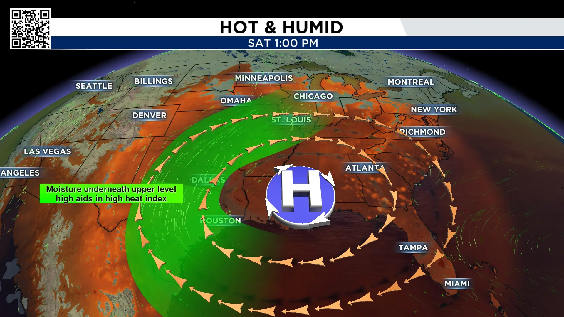
High pressure builds in this weekend, bringing a hot, humid and dry weather pattern that looks to stick around not only through the weekend but much of next week.
Temperatures will climb into the upper 90s, with the potential to hit 100° on a few days next week. With the humidity, it will feel even hotter.
Lala and Hawaii:
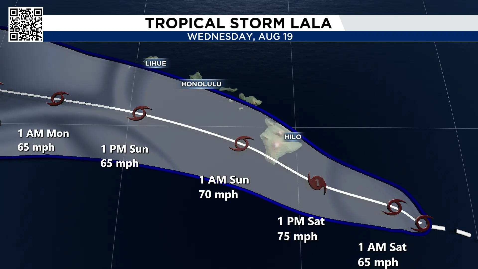
Something incredibly rare is about to happen in Hawaii. Did you know That the Hawaiian island chain has only been hit by a hurricane two times since reliable records have been kept going back to 1949. Cat 1 Dot in 1959 and Cat 4 Iniki in 1992 both hit Kauai.
Saturday could be the third time a hurricane hits the islands with Lala moving through Saturday night. It may make a direct hit on the southern part of the Big Island.
The Big Island has only been hit by three tropical storms. Unnamed in 1958, Iselle in 2014 and Darby in 2016. This would be the first hurricane hit for the Big Island.
Here are the impacts. The biggest and most dangerous is rain. It’s not out of the question that two feet of rain could fall in the Big Island creating deadly mudslides. Orographic lifting will enhance rain rates and the topography will race the water down.
Hurricane force winds will also hit parts of the big island lashing trees and knocking out power.
Waves as high as twenty feet will lash the southern part of the big island.
And even without a direct landfall, rain totals will not change. Hurricane Lane in 2018 was 150 miles west of the big Island and dropped 58” of rain near Hilo.
Sunday, this storm moves away from the Islands.
Atlantic Ocean:
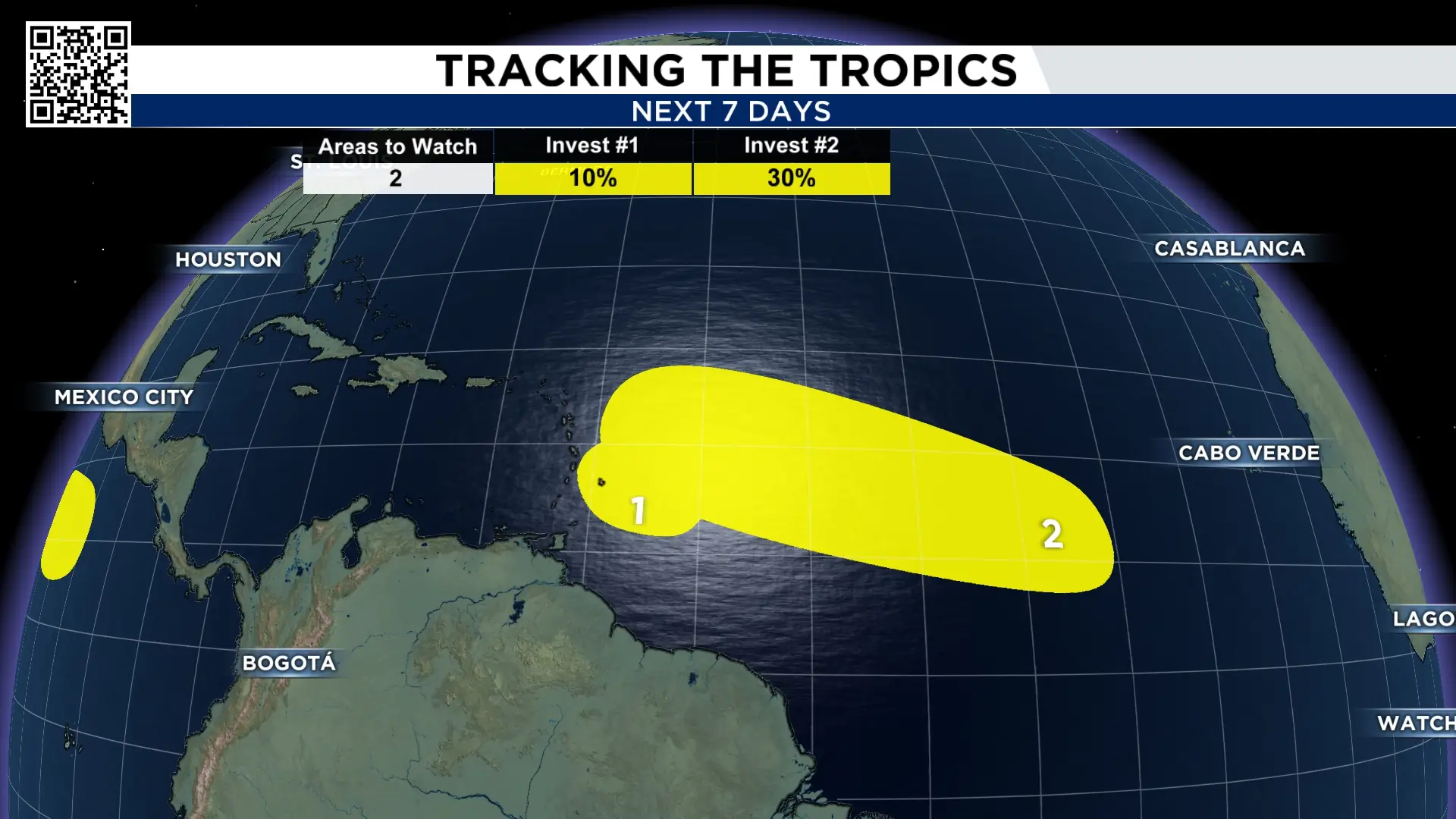
While the Pacific Ocean has Lala, the Atlantic basin has dry air and strong wind shear. This is preventing the two disturbances we’ve been watching this week from strengthening. I doubt either of these areas becomes Dolly, the next named storm in the Atlantic.
10 Day Forecast:
I don’t have a chance of rain in the forecast until possibly Monday August 24th!

More Stories Like This In Our Email Newsletter
