
You are going to love the way it feels Friday:
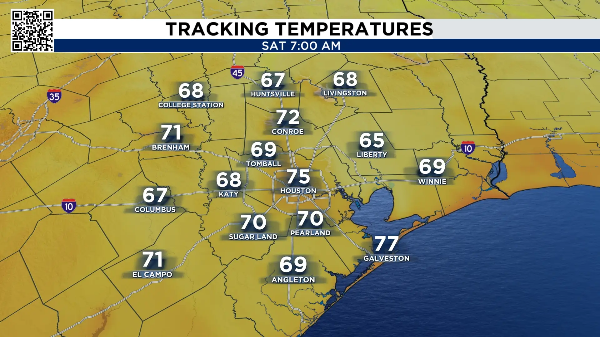
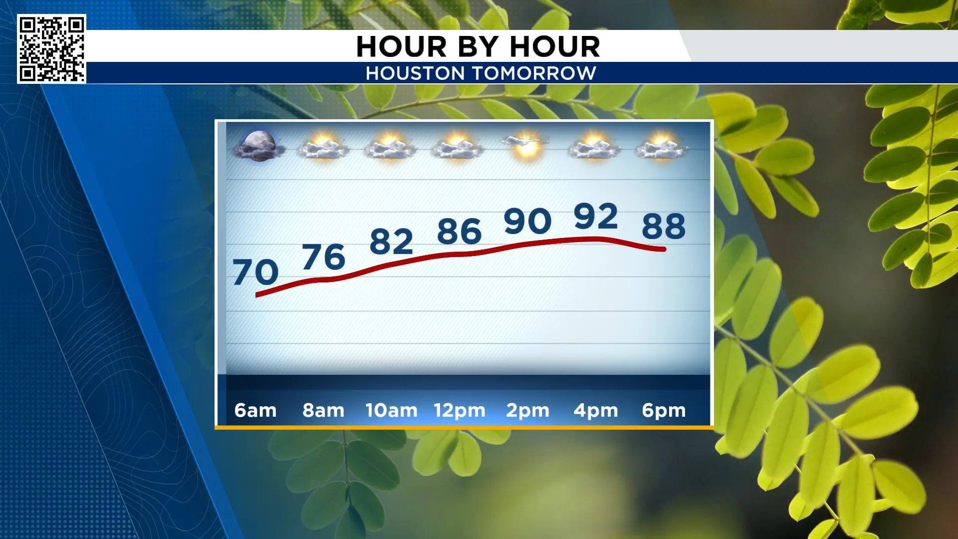
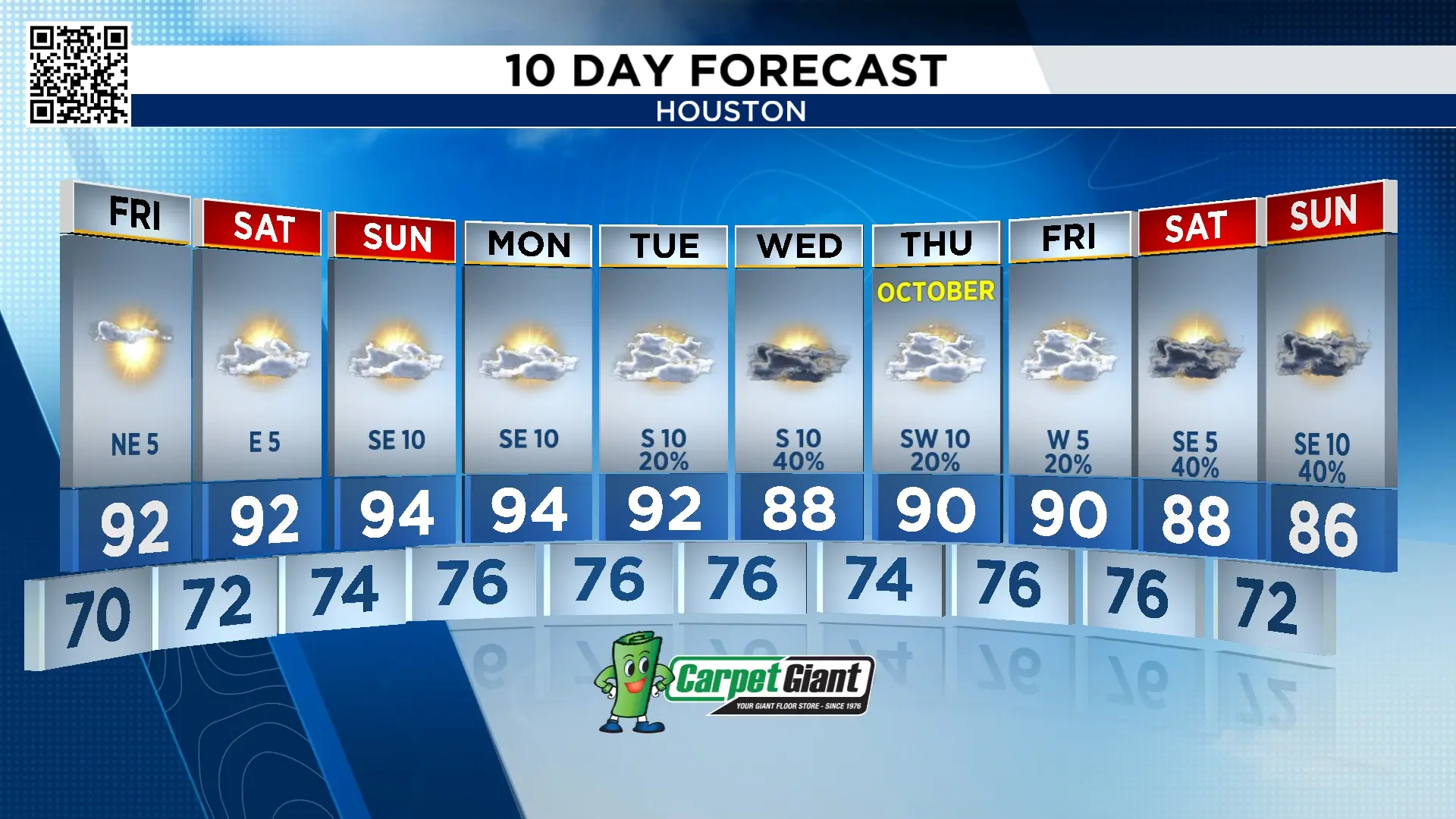
Dry air moves in late Thursday, we’ll wake up to a refreshing feel Friday morning. Some cities north of I-10 we’ll start in the 60s! Along I-10 and south we’ll be in the 70s. But even those of us with mild temperatures will feel good with a low humidity in the morning and throughout the day. While 70° in Houston does look that cool, the last time temperatures were below 71° was May 28th. It’s been a long humid summer.
Humidity back Sunday:
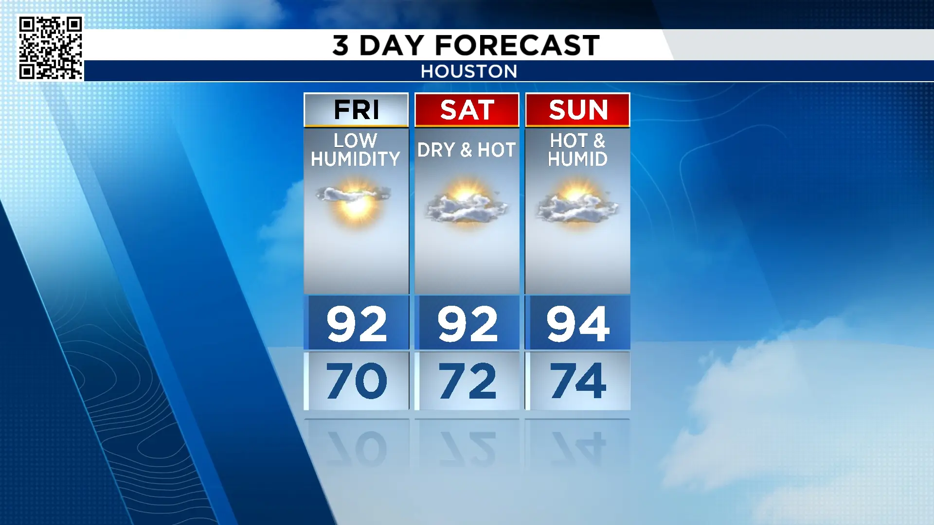
The day air and low humidity stays for the start of the weekend. But on Sunday it will again feel like summer with heat, humidity and high temperatures in the mid-90s.
Never trust the first fall cold front:
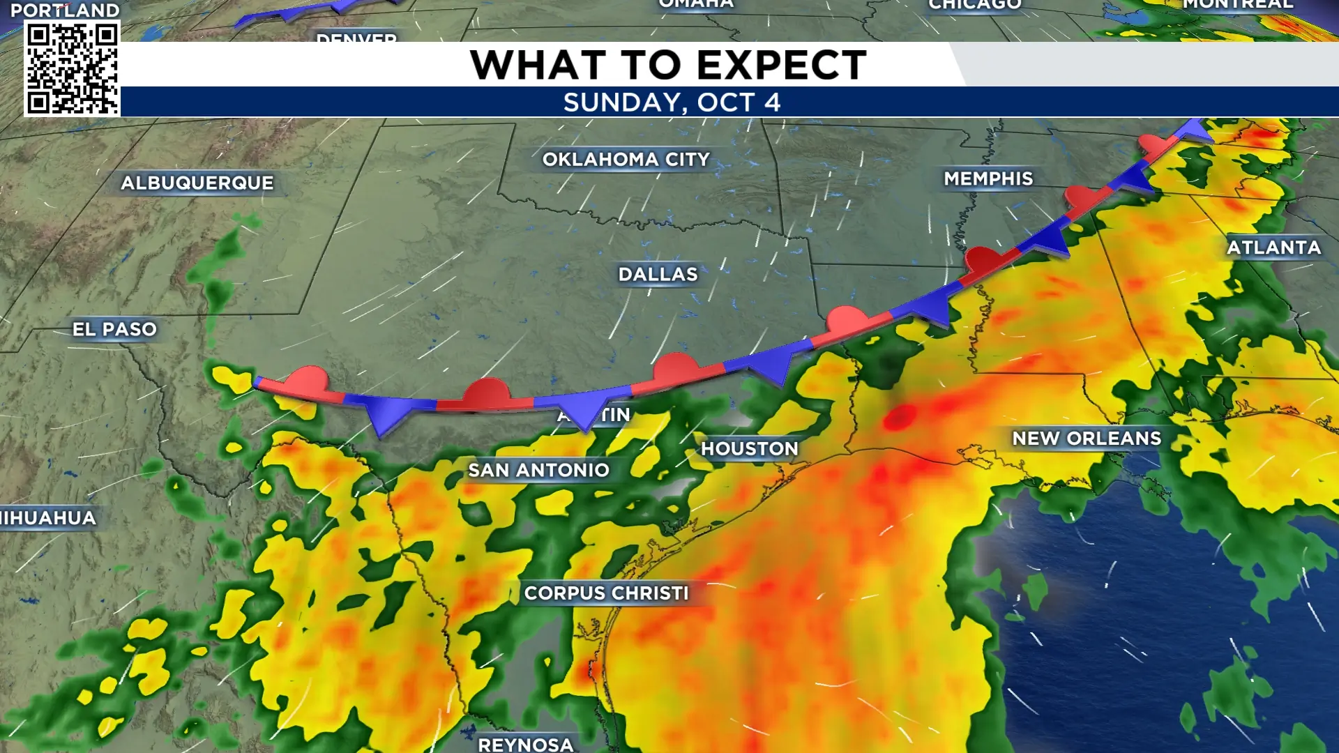
Two things I’m watching next week are tropical moisture from the Pacific and a cold front. The Pacific Ocean has two hurricanes, Cat 1 Odalys and Cat 4 Polo. Both of those will send tropical moisture to Arizona, New Mexico and Texas. Some of that moisture could arrive in Houston Wednesday with a cool front moving through at the same time. But what looked like the cold front moving through yesterday, now looks like the front will stall in Texas. That means we won’t get a cool down or lower humidity. But we could get off and on storms Tuesday through Sunday the 4th of October. We’ll keep updating this forecast with the changes that come along.
Tracking the tropics:
All is quiet in the Gulf. There is one area near Cabo Verde being monitored by the National Hurricane Center. It’s off the coast Africa and drifting north. It has a 80% chance of becoming our next named storm which is Gonzalo. There is currently no threat to the United States.
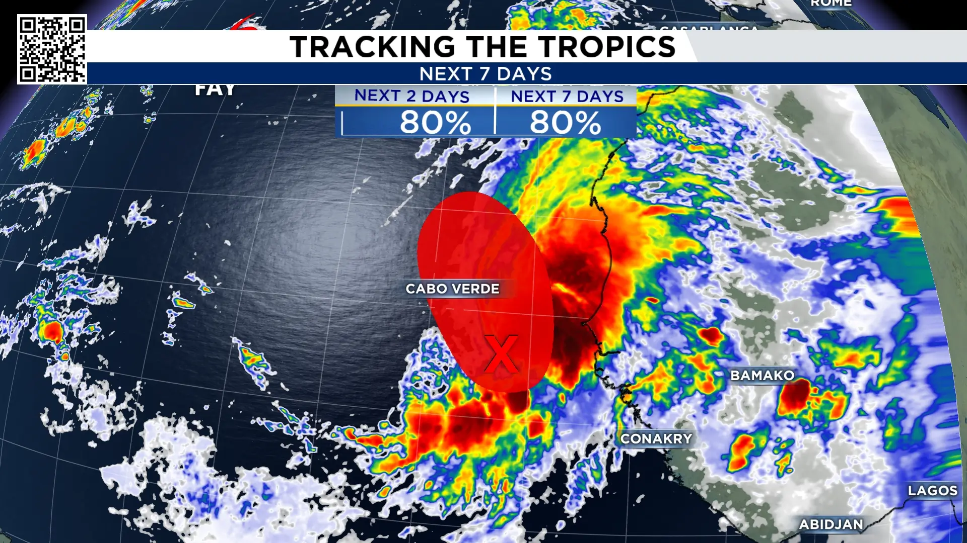
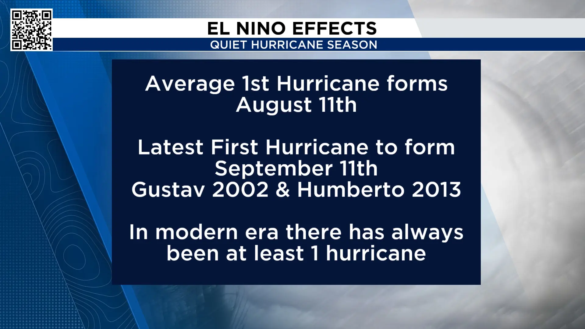
So far this hurricane season we’ve had six tropical storms. We have not had a hurricane in the Atlantic basin. The latest first hurricane to form was Gustav and Humberto, which formed on September 11th. This means our 2026 hurricane season set a record for the latest hurricane to form.
Extended forecast:
Our next chance of rain arrives next week. And there is the chance we get off and on rain through the first weekend of October.

More Stories Like This In Our Email Newsletter

