HOUSTON – The Woodlands will host the Ironman North American Championship on Saturday.
Athletes will swim 2.4 miles, bike 112 miles and then run 26.2 miles all in one day.
Recommended Videos
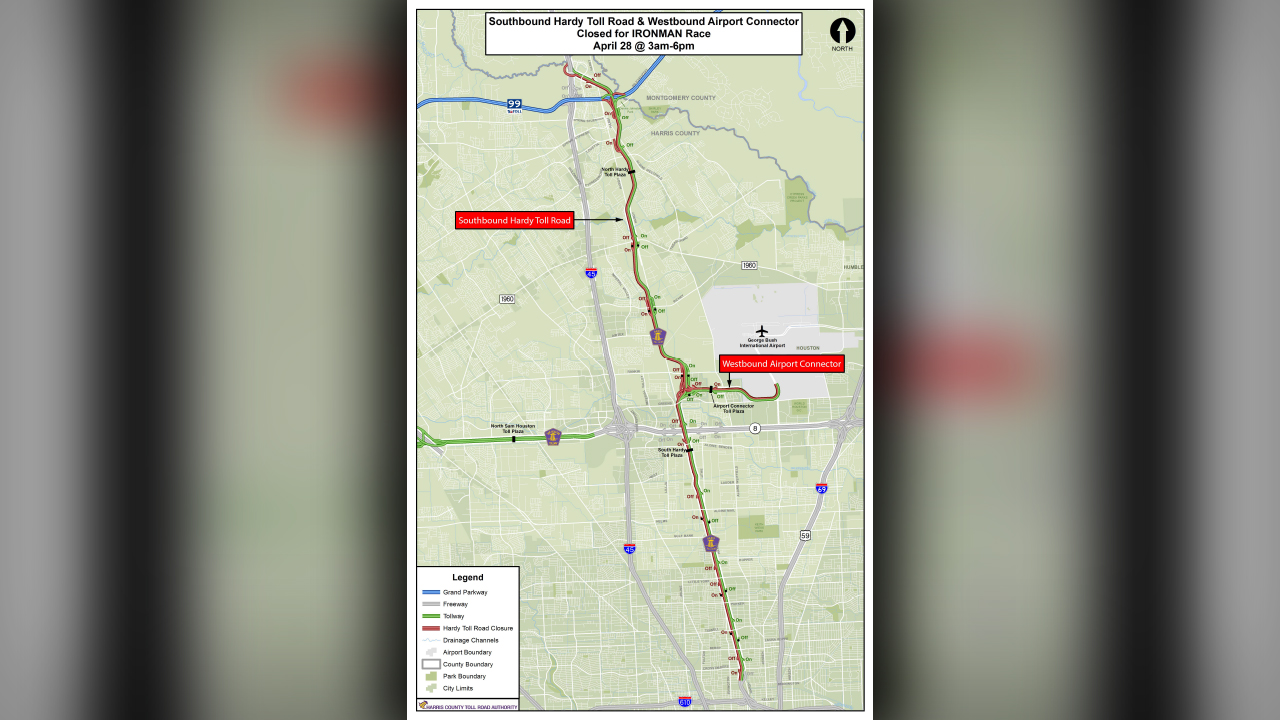
Check out the Ironman traffic impact map.
Here are the best places for fans to watch the race:
SWIM The 2.4-mile swim begins at North Shore Park and ends in the canal at Town Green Park. (Map)
1. Lake Woodlands Pkwy Bridge just east of North Shore Park - this area will give you a great view of the lake and the swimmers. 2. Hughes Landing parking garage - bring your binoculars for this spot, but it’s still a high vantage point to see the start of the swim portion of the race. Plus, you can walk over to various points in the race from here. 3. The canal between Lake Woodlands - this is near the swim finish and is best best accessed from the stairs down to the waterway off Grogan’s Mill. 4. The north side of Towns Green Park - If you watch from here, you can see the transition from swim to bike. It’s fun to see the volunteers helping the participants quickly move from one portion to the other. There’s a lot of action here.
BIKE
The 112-mile ride is out and back on the route twice. (Map)
1. North Shore Park - The bike route starts in The Woodlands, heads down Lake Robbins Drive, down Grogan’s Mill out to the Hardy Toll Road. North Shore Park is a good place for families and kids to watch the race.
2. Along Lake Robbins Drive - The streets and neighborhoods are heavily congested during the bike portion of the event. In order to avoid getting stuck out on the course, the best option for the bike start and finish is along Lake Robbins.
3. Spring Stuebner and Interstate 45 - If you want to get further away from the action, this is a good location to grab lunch and watch the race. Bikers will wind through this area during the first half of the bike race.
4. Hardy Toll Road - The bikers say they really enjoy the open route of the Hardy Toll Road in this race. Venturing out and parking along the Hardy Toll Road will give you the opportunity to see athletes sailing at top speeds on the open course.
RUN The 26.2-mile run is on a three-loop course. Runners will go down Lake Woodlands Drive, Woodlands Parkway, toward the mall and then back around. (Map)
1. Market Street - this is a good spot to cheer on the runners! Remember, there are many road closures so the best locations to enter Market Street is along Lake Woodlands Drive, Six Pines Drive and Grogans Mill Road. 2. South Shore Park - This park has plenty of water fountains, gazebos and covered areas to hang out and watch the runners during the race. 3. Westin Hotel - get a great view from high above if you have a chance to watch from the Westin. 4. Waterway Square - This is the finish line for the event. There are also many restaurant options nearby.
The race starts around 6:25 a.m. The elite participants may finish in a seven- to eight-hour window, but for others it could take more than 12 hours to complete. The course will officially close at midnight.
The race will affect traffic on the Hardy Toll Road. Below is a map showing the closure.